Mount Washington
New Hampshire Highpoint, 6,288 Feet
August 23, 2002
#1 on NEHH
#1 on NE111
#1 on NH48
#1 on NE67
#1 on NEFF
#18 on US State Highpoints List
![]()
2018 Note: Here’s the deal. I’ve hiked Washington… lemme think… five times. This report as it now reads was from my fifth climb of it, with Hoang. I’m sure that I’ll hike it again with my son Calvin, at which point I will be able to provide bigger and nicer pictures. Until then, here’s our 2002 experience…
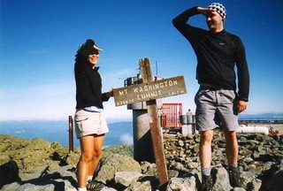
I hiked to the summit at the end of August some years ago. It was a warm t-shirt-and-shorts day at the base, but 20 degrees with snow, ice and 115-mph winds at the summit; Many warning signs mark the route up. Dozens of hikers who ignored such warnings are commemorated by trailside monuments and crosses.
–Lonely Planet Guide to New England, 2001
Mount Washington has what is commonly referred to as ‘The worst weather in the world’- with the world record wind speed of 231 mph occurring there. Among the Mt. Washington weather station’s many other records are: most weather instruments destroyed, most wind in 24 hours (nearly 3100 miles of it), and lowest windchill (a combination of 100-mph winds and a temperature of 47 degrees below zero, a severity unmatched even in Antarctica.
–Bill Bryson, A Walk in the Woods
When a northbound hiker leaves Vermont he has completed 80 percent of the miles but just 50 percent of the effort – New Hampshire is hard.
–Dan “Wingfoot” Bruce, Thru-Hiker’s Handbook
With those quotes in mind, Hoang and I went to bed the night of August 22nd in the relatively cozy confines of the Lakes of the Clouds AMC hut high up in a col between Mt. Monroe and Mt. Washington, at an elevation of over 5000 feet. Outside, the weather was pretty atrocious, as it often is up on Mt. Washington, with a chilly rain falling through a fog that reduced visibility to mere feet. We had had beautiful weather over the previous three days in the Whites. But this was Mount Washington.
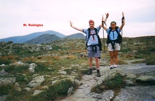
The smalltime hikers, such as ourselves, and the tourist day hikers who had come down from their train/van/car rides to the summit, had overbooked the hut. One particular day hiker provided Hoang and me with a good ten minutes of snickering laughter; he arrived bedraggled and disgruntled, rat’s nest hair, and looking as though he was on the verge of tears for hours. For some reason when he busted out the giant Pringles can as his smiling mom cheerily arrived, we just couldn’t contain ourselves… you just had to be there.
Adding to that were the twelve thru-hikers who had decided to stay the night (8 of which holed up in the “Dungeon,” with the remaining four sleeping on the floor and benches), the two moronic couples who appeared at 8 the night before; bedraggled, soaked, cold, and hungry, wearing only tee shirts, shorts, and trash bags, and the “Creepy Brothers,” who certainly looked like thru hikers, but were in fact three social misfit weirdoes who began ascending Mt. Washington in the dark at 8:30PM the night before, arriving at the hut at 3AM to everyone’s extreme displeasure.
Side note on the “Creepy Brothers”: they hiked in lockstep with each other, no matter how steep the grade, and never talked to anyone. They reminded me of the Hanson Brothers from “Slapshot” – a lot.
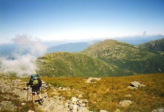
For our part, we had arrived quite early in the day and politely chatted with a few people and quietly read books and poked around outside a bit.
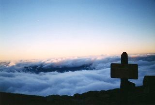
The morning of our attack on Washington dawned around 6AM with crystal clear blue skies above us, and the valleys enshrouded in clouds below. The incredible beauty of the scenery stunned those of us who awoke early and ventured outside in a respectful silence. I moseyed up to the “Stinky Couple,” recently married southbound thru hikers from Arkansas, and had a nice chat, but man, did they reek.
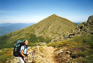
After breakfast, Hoang and I wasted no time in getting our gear together to begin our assault on the highest point north of the Carolinas and east of the Mississippi. With the temperature perfect for strenuous hiking, we set out and immediately passed several day hikers who were shockingly winded. About 15 minutes up the mountain, we passed a group of Boy Scouts, one of whom looked freakishly like my brother-in-law, and all of whom looked embarrassed to be passed by my 5’3″ fiancée with a full pack. I think she took it personally and wanted to show them that she was as strong and determined as anyone on the mountain that day.
For the record, she was.
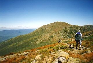
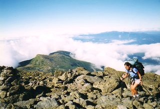
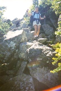
The northbound AT trek to the summit involves nothing more than picking one’s way over a giant pile of child size boulders, which is not easy. Some stretches required using hands and frequent rests are the norm. After about an hour or so, and after passing several crosses marking some of the deaths that occur on the mountain every few years, we arrived at the summit.
To say the summit is an odd place is an understatement. There are several buildings up there, owing to the fact that it was privately owned for a long time. TV towers, TV transmitters, train station, Tip Top House museum, gift shop, parking lot, observatory, giant concrete observatory deck… there is way too much crap on top – and I’m not even talking about the multitudes of folks pouring out of their cars ($22 per passenger to drive up in 2002) and the cog railway ($49 per passenger), which, while of historical importance, is a relic that should maybe be retired.
Three of these locomotives slog up the mountain all day long, spewing thick, black, sulphurous smoke for miles. It is unpleasant. While we were up there, there was some debate over whether the parade of SUVs up the summit road or the train were worse for the environment, which never reached full conclusion.
With the temperature as good as it ever really gets up there (~50 with 15mph winds), we still had to duck into the visitor center for a hot chocolate and the first hot water in 4 days. Within a few minutes, the place was packed with tourists. It was interesting to note that the thru hikers had a definite space bubble around them due to their ripe stench. Some tourists were treating them like wildlife; “Oooh, look honey, a thru hiker! Keep your distance! Lets get a picture!”
There was museum which we decided to save our money on, and Hoang enjoyed the looping video, “Breakfast of Champions” which is a comedic short in which a man tries to enjoy some Wheaties on the summit during one of Mt. Washington’s famous gale force episodes. Our patience wore thin and we were soon on our way back outside (in hats, jackets, and gloves now), and began the difficult descent north along the Appalachian Trail. I wish we hadn’t left when we did, however, as a thru-hiker (trail name, “Ballpahk,”) with whom I had spoken at length the night before, got a free tour of the actual weather observatory for the other thru hikers whom we had befriended during the week. I’m confident we could have scammed our way in… oh well.
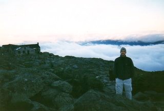
From the summit on a clear day such as the one we had, one can see well over 100 miles into Canada, Vermont, and Maine. It was breathtaking (once we got over the mass of humanity and unnatural additions up there) and sobering. The northern Presidentials form a horseshoe pattern so, as we set out down the mountain, we could see our ultimate goal a mere 6 miles away. 6 miles down your street these are not.
Spending the whole day completely above tree line and hiking across barren rock fields can be a trying process. With the bright sunshine and a light breeze, we could not have hoped for a better day. There are numerous other trails traversing these mountains, which cause some confusion for the careless hiker. Bright yellow splotches and cairns replace the familiar AT 2×6 white rectangles. On typical days, it is usually so foggy, icy, and/or snowy, that a white paint blaze would be nearly impossible to spot. Thankfully, the New Hampshire AT does not summit every peak it nears (like down south), rather, it skirts around each mammoth rock pile; being sure to still climb and descend a considerable amount. Between Mt. Clay and Mt. Jefferson on our way around the rim of the Great Gulf Wilderness, we met two flip-flopping thru hikers who were pushing 70 years old. They looked strong and healthy and gave Hoang and I all the inspiration we needed to finish our hike.
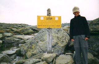
The backside of Jefferson was brutally steep, and I am of the opinion going down it was more difficult than up. Lots of scrambling, ambling, and much thought about foot placement resulted in a long, slow descent. Hoang once again amazed me with her ability and persistence. Next up was Mt. Sam Adams, which proved pretty difficult after such a long and hard day. We were resting much more frequently at this point, but we were still way ahead of any “average” time estimates for our hike. Once over the shoulder of Sam Adams, we approached Thunderstorm Junction with its famous gigantic cairn. I remember as an 11-year-old being impressed with the 12-foot pile of rocks marking the way. However, in the years since then, its impressive scale has been knocked in half to about my height – still impressive, but not as cool as I remember.
As our energy and water reserves were about depleted, my overused encouragement of “right around that mountain” finally rang true, as we skirted the north side of Mt. Adams, the second highest peak in the Presidentials, and some say the toughest to summit. There aren’t any roads up here! In fact, Madison hut, which is nestled between Adams and Mt. Madison, is the most remote hut by far. The crew here is regarded as the toughest of the bunch, as they must hike in the supplies the up farthest and steepest route.
Amazingly, the trail around and down Adams was almost graded as some trail volunteers spent enormous time and effort placing boulders in such a way as to make one feel one is walking down steps or along a simple path. Of course, the fact that one could have one misstep to the left and end up paralyzed or dead never leaves one’s mind. This “easy” area gave me a chance to assess the bright strawberry red hue the back of my legs and neck had acquired. I was pretty badly sunburned, but I was certainly not upset. Hoang, of course, doesn’t burn…
We were (once again) one of the first arrivals for the night at the hut, showing up around 3PM. I realize hiking is certainly not a race, but I have to write here for posterity, novice hiker Hoang and I were only passed by one single thru hiker all day, and that was “Tin Man,” who was racing to the bathroom! I can’t give her enough praise for her efforts on this highpoint, and the five-day trip as a whole. She carried a full pack, she climbed the same mountains, she ate the same meals, she lacked the same showers and yet she had a smile on her face at the end of every day. The night at Madison Hut was no different, as she smiled and marveled at my nerdy conversation with “The Canadians” during which we quizzed each other on geography, exchange rates, and other various nonsense. We both smiled as we said goodbye to a lot of the thru hikers we had met, who were continuing on to a campground several miles ahead. And Hoang smiled all through dinner as the dreamy, rugby playing, Northeastern attending, rugged, oh-so-handsome, John served us our meals.
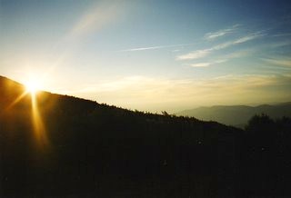
There were three more things that ended this incredible day of highpointing, making this one of our best trips ever. One was the beautiful sunset. Another was when I swelled with pride when one of the thru-hikers, “Wildflower,” marveled at Hoang and couldn’t believe she wasn’t a “real” hiker. In fact, she was dubbed, “Honorary thru-hiker!” That’s just awesome… As awesome as that was for me, it couldn’t compare to Hoang’s experience as she was preparing for bed.
After washing her face with the icy cold tap water, she began brushing her teeth just as some woman sat down on the can, a mere three feet away. Unfortunately for Hoang, she couldn’t finish brushing, as the woman in the dark, tiny bathroom began passing gas the likes of which Hoang has never heard. The woman just did not care, as she regaled my fiancee with repeated machine gun blasts and cluster bombs. Hoang escaped the confines of the bathroom and nestled in beneath me in the four-high bunk bed.
We said goodnight to each other and I shut my eyes to sleep one last night up in the mountains. Almost immediately, my bunk started shaking from below, so I asked Hoang what was going on. The poor girl couldn’t even speak, so I turned my flashlight on her face only to see tears streaming down her cheeks. At first I was alarmed something was horribly wrong, but then I saw her grin from ear to ear, and realized what was going on. It was five minutes later and that woman’s toileting experience was still on Hoang’s mind.
Highpoint Difficulty Rating: 6
Hike Distance: 36 miles (over 5 days)
Distance from Current Residence (New Britain, CT): 285 miles

Leave a Reply