Slide Mountain, 4180 Feet
February 21, 2014
5.4 miles solo via Pheonecia East Branch and W-C-S Trails
# 1 on the Catskills 3500 List
# 68 on the Northeast 111 (115) List
 I made the decision years ago to not go crazy with the writing on my Catskills pages. And when I write up the four required winter climbs (of mountains that must be climbed twice), I really don’t feel like writing too much. There really is no point in doing so.
If you want to read all about climbing Slide Mountain during ideal conditions, you can do that on my page here. To complete the Catskills 35er Challenge, one must climb four specific mountains in the winter. This is one of them.
I had selected February 21st as my Catskills winter day six weeks prior to my hike. As with any winter hike, the weather forecast is paramount. As the data approached, it looked a bit iffy to say the least.
I’ve always said that the absolute worst hiking condition is heavy 33 degree rain. The forecast changed from exactly that to lighter, off-and-on rain so I packed my gear, went to bed early and made a go of it.
 My wonderful wife, who trusts my fitness, skills and experience enough to support this type of lunacy, simply said the night before, “I don’t understand this winter hiking stuff, and it doesn’t sound fun or the least bit safe, but have fun.” Kisses!
Awake at 4:15 AM and at the trailhead at 7:35 (My slower travel time was due to rain and fog on the way), things were looking good. It was even warm enough to not even need a hat and it wasn’t raining at all.
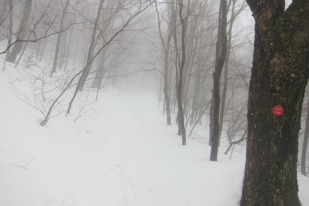
I wasn’t too concerned about the 5.4 mile up and back hike. I’d done it before and remembered by surprised that the highest peak in the Catskills was a fairly gradual hike up. (This is because there used to be a fire tower near the summit and therefore, vehicles used to drive up here.) At this time of day and with the heavy rains holding off, my hope of a packed down trail seemed to be coming true. No, it wasn’t ideal snow-shoeing, but it wasn’t too bad at all.
 Anyone who has climbed from west knows there are basically four waymarkers on the way up: The first trail intersection at .7 miles, the sharp left-hand bend at about 1.4 miles, the 3500 foot marker, and the trail intersection at about 1.8 miles.
On a day like I had, when you can’t see anything else, these things are beacons of hope. I was making good time, but as I neared the summit, the weather picked up a bit and as the ridge became more exposed, the wind started whipping up.
When that happens to pine and fir and hemlock trees with massive lumps of snow on them, those massive lumps of snow tend to fall down. My goal for the final push up Slide was to avoid one of those massive lumps of snow falling down my neck and back. Trees were bending all around and snow was falling everywhere I looked, but I remained unscathed.
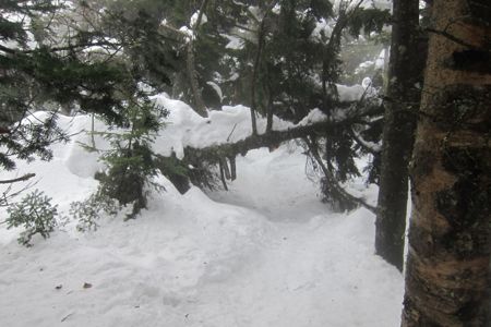
The light rain was now a light icy drizzle, but I was near the summit. One (of the many) tougher things about snow-hiking, which no one tells you about, is that the blowdowns that can usually be easily ducked under become very annoying blockades.

It looks benign, but it’s a pain to get by

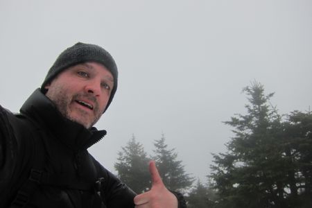
Summit Nerd
The summit in the middle of an icy cloud was completely unrecognizable. Or rather, the spot a couple hundred yards north of the summit – the one with the views – was a bit different than it was last time I was here. It was a mess. I took a 12 second video that I just joined Vimeo to show you.
Not exactly a place to lounge about and relax. I stayed for about two minutes and began to retrace my steps back down the mountain. The first half of my descent was fast and easy as the snow was still holding up. Each step allowed me to slide a little bit and it seemed like I got down to my car in no time at all.

Fun conditions!
In fact, I couldn’t believe it when I got back to my car at 9:20. Wow, I was MOVING down that mountain.
I was soaked, but 99% of it was from sweat and not the rain, which had again subsided. I stripped down, changed my shirts and jackets and hit the road up and around and down to the Balsam Mountain trailhead… a hike that turned out to be much, much more difficult.
My Catskills 3500 pages
Official 3500 Club

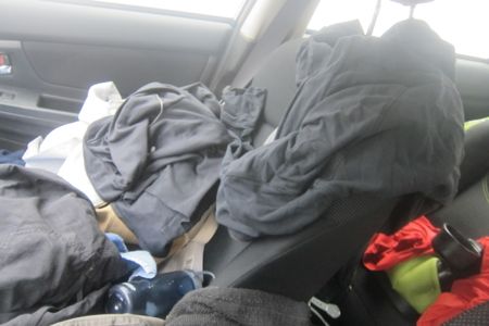
This was my car after the first hike. You should have seen it after the second!

 Lawrence Rowe says
February 6, 2020 at 10:52 pmCurious about crossing the Neversink. I’d rather stay dry when just starting out. Were you able to cross the river with no problem? Also, did you take the direct route up or do the loop?
Lastly, did you use spikes and poles?
Thanks for any information you can provide.