PattaconkaCockaponset
Chester/Haddam, ~ 4 miles
March 15, 2009
A funny thing happened after “publishing” the page describing my experience hiking with Rob Butterworth along the Cockaponset Trail. It turns out that the esteemed Mr. Butterworth has a kajillion friends who have a strong interest in him and/or his trail(s). I receive so much positive feedback from it… I think I’ll be hiking with Rob more in the future…
No. In fact, not only did I thoroughly enjoy my time in the woods with Rob, I’ve since made a few more contacts heavily involved with the Connecticut Forest and Parks Association (including the Executive Director) and the CT DEEP. And, as it turns out, they seem to like my little website here so I guess I’ll keep it going.
And speaking of keeping things going, after Rob and I hiked 7.4 miles south on the Cockaponset, we had to return to our cars somehow. And there is no better way to do so other than the four side trails that parallel the main trail for much of the trek. The return trip does require a bit of backtracking on the Cockaponset, but since Rob and I (okay, mainly Rob) cleared the path down – he being the slightly obsessive trail maintainer/manager – those repeat sections were like a pristine, stick-free brand new path!
Well, at least there was no need to bend over and pick up sticks on those blissful sections. Let’s get to it.
![]()
South Pattaconk Trail, 1.6 Miles
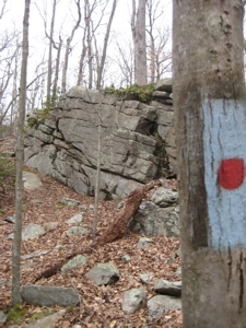
After hiking all the way to Route 148 to officially finish the Cockaponset, we turned around and headed back north. After a few minutes, the blue/red dot blazed South Pattaconk Trail veers left and crosses Filley Road. We were in Chester, a town mostly associated with the Chester-Hadlyme Ferry and its artsy, uppity little town center.
I’ve enjoyed meals at two Chester restaurants – the incomparable Restaurant du Village (now closed) and the popular Pattaconk 1850 Bar & Grille. Hmmm, the Pattaconk? Seems like that’s a popular word ’round these parts.
Unfortunately, I can’t really find any online history of what surely were the Pattaconk Indians or perhaps it was a word in whatever Wauramaug/Pequot/Mohegan/Narragansett offshoot tribe lived here. Heck, something tells me this page will get hundreds of readers again and maybe someone knows. We’ll see.
Oh yeah, the trail. The trail is fairly unremarkable to be honest. It provides a more straightforward walk from 148 – by the way, I know I mentioned the ferry, but Route 148 actually IS the ferry route – to the Pattaconk Reservoir recreation area with in the Cockaponset State Forest.
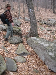
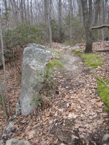
On the way there, there is a short climb that Rob joked is locally called, “Endless Hill.” The name derives from the fact that it’s pretty much the only hill worth noting in these woods rather than it being difficult to summit. Shortly thereafter, we were treated to a baby cliff where we stopped for a snack and some reflection.
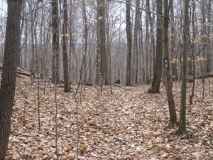
See Rob’s head just cresting the “Endless Hill”
Further on, there is even another little baby cliff which the trail ascends, requiring 20 seconds of exertion. And before I knew it, we crossed the Cockaponset and were officially on the North Pattaconk Trail.
![]()
North Pattaconk Trail, 1.2 Miles
The North leg of the Pattaconk is a bit more scenic, traveling along the edge of Pattaconk Reservoir. The reservoir is a DEEP property and, according to Rob, is quite popular with Connecticut’s burgeoning Eastern European population for some reason. It didn’t look like Zagreb or Minsk to me… it looked like any of the other 4000 reservoirs I’ve seen on my hikes. But hey, if they’ve claimed it, I’m not about to argue with them. Enjoy your tiny beach and cold water.
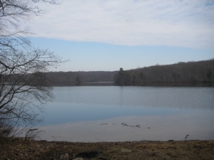
All along the shore there is evidence of active beavers in the area. Many trees along the shore were beavered, but not taken away. i’m not sure this location is idea for them, but looking across the water Rob pointed out a massive beaver hut.
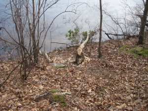
The hut was very near the state-of-the-art solar powered composting toilets that Rob was quite proud of. I think he mentioned a camp over there and that these toilets were two of the very few super advanced port-a-lets in the state. While fascinated, a 45 minute detour around the reservoir to use them wasn’t in the cards.
Maybe someday.
We passed another family out for a hike who were very appreciative of Rob’s efforts and seemed excited to tell their kids that they were in the presence of the man responsible for their clutter free hike. The kids were a bit preoccupied with throwing rocks into the water, but it was cool to see and hear their excitement at meeting Rob.
Which is deserved. These bridges don’t build themselves!
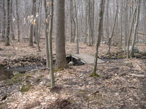
The North Pattaconk shares the Cockaponset for a minute, then cuts a corner of it to reach its northern terminus a little further along the “mother trail.” We had to walk about 3/4 of a mile on the Cockaponset north now, in order to reach our next trail…
![]()
Old Forest Trail, 0.5 Miles
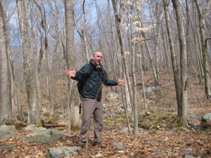
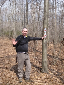
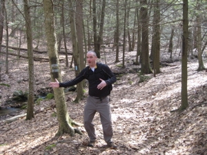
For some reason I took five pictures along this short path. I have no idea how I could possible write enough to warrant so many pictures. Heck, in this first picture of me at the start, you can almost see the end of the trail!
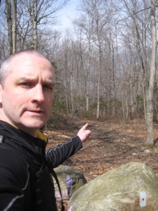
I said “almost.” The Old Forest Trail is probably an old forest trail. Um. Yeah. It parallels the Cockaponset rather closely and at one point, I took a fantastic picture of the little bridge on the Cockaponset near the WPA dam:
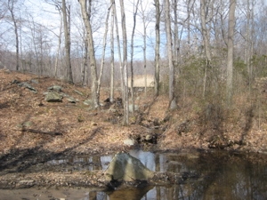
The trail is pretty much an old road, and was perhaps the Cockaponset at one point (Rob very well may have told me, but I don’t exactly take notes while hiking) but that was moved west due to the erosion issues I saw here. You want to see some erosion issues? Okay:
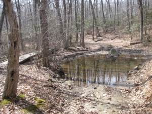
As I was saying, this trail is rather boring and… What? You want MORE erosion pictures!?
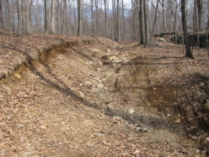
Enough? Good. Because I’m done with this trail:
![]()
Wildwood Trail, 1.4 Miles
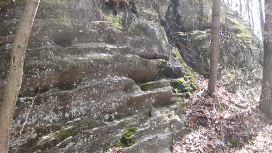
The last trail of the day, the Wildwood, is a straighter shot to Beaver Meadow Road than the Cockaponset, which was now east of us. And this is definitely the best of the four side trails. It begins at the base of a cliff and some stone stairs on the Cockaponset.
The cliff is large by southern Connecticut standards and has some interesting geological features in it.
The trail passes through some bright green moss fields and thousands of feet of mountain laurel. I really liked the feel of the Wildwood – and not just because I was now realizing I was almost back to my car after 14 miles of hiking. No, I just liked it for some reason.
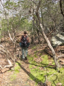
It also seems to be Rob’s trail managing practice ground. We hopped across a little stone bridge he laid down. We climbed up his first attempt at a stone stairway built into a hill. We hiked up and down a series of hills via soil-saving switchbacks at a perfect incline. Rob didn’t say it, but I think he does all this stuff over here (re-routing, bridgework, stone work) on the less-popular Wildwood before doing it over on the Cockaponset.
Regardless, it’s fun to hike with the person responsible for all this stuff. (And I learned a lot too.) Of course, Rob’s job (errr, hobby) isn’t all glamourous/backbreaking stone stairway work. Here, I got a picture of him jotting a note to himself about a blowdown that he’d have to return to with a chainsaw.
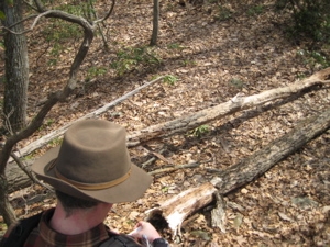
Okay, maybe the life of a trail maintainer IS all glamour.
We finished our day passing yet another hiker – this time an 18 year old kid out alone with his dog. Rob smiled about the fact that we’d not seen or heard a single ATV rider or really much litter at all. I joked that that kid was most likely going to go smoke some pot and Rob agreed, but at least he wasn’t tearing up the trail.
The Wildwood finished up on the Cockaponset about a quarter mile from the road and our cars. We shook hands, promised to do it again sometime somewhere else; I wonder if Rob will pick up every stick on others’ trails?
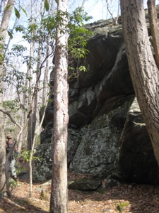
Again, a hearty thank you to Rob not only for the work he does (I haven’t even mentioned the demonstration trail at the CFPA headquarters in Middlefield he pretty much maintains) but for providing such insightful tidbits during our hike.
Cheers.
![]()
CFPA Trails Map
CTMQ’s Cockaponset State Forest
CTMQ’s CFPA Trails & Blue Trails Challenge

 Rob says
May 8, 2009 at 4:23 amHi Steve,
Thanks for another great write up! Regarding the Old Forest Trail-it was orignally a forest road and was abandoned for whatever reason. (Washed out and eroded perhaps?).
Also, you are quite correct, those bridges don’t build themselves, but I didn’t build that one. I’m not sure who did.
And yes, I am bursting with…..pride over the composting toilets!
Regards,
Rob
 Rob says
May 8, 2009 at 5:15 amHi Steve,
Two other things I noticed on a second read.
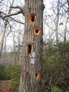
I’d like to note to hikers that the blue/red trails are changing their blazes this year. They’ll still be blue/red, but it will be the familiar blue rectangle with a square of red at the bottom instead of the dot. The Wildwood and Old Forest Trails have already been reblazed and if the weatehr permits the North and South Pattaconk will be done in the next month or so.
The second is minor. The dam is a Works Progress Administration (WPA) project. It was also part of Rosoevelt’s New Deal, along with the CCC and NRA. No, not that NRA, the National Recovery Administration.
Thanks again,
Rob
 Mark C says
May 8, 2009 at 7:04 amAnother good article, Steve.
You are just scratching the surface of the man that is Rob. In addition to his work on the Cockaponset Trail, he has also provided trail care advice on an international level.
Cheers,
Mark
 Eric says
May 8, 2009 at 7:08 amSteve,
Thanks again for all of the fun write-ups and your great pictures along the Blue-Blazed Hiking Trail system. The system is a Connecticut natural treasure, and Rob Butterworth is definitely a “Trail Stud” and amazing volunteer.
Best,
Eric at CFPA
 Rob says
May 8, 2009 at 7:09 amWhat, Canada? I thought that was a part of Michigan or something…..
 Laurie Giannotti says
May 8, 2009 at 7:14 amOK, now can Rob work on installing our bath tub?!!
 Carolyn says
May 8, 2009 at 4:42 pmI also think Rob has a great butt, having hiked and biked behind him many times(no one ever gets in front of Rob on the trail or on the road). Great articles on Cockaponset!
 Rob says
July 10, 2009 at 4:38 amA quick update. The weather has cooperated with us and all of the blue/red trails have been reblazed with the new “underbar” style blaze. Enjoy!
 Dawn Alger says
September 14, 2020 at 11:15 amThanks for the article!
Now that it has been 11 years, did you ever get any information on Pattaconk or Cockaponset or any of the indigenous peoples for which these parts are named?
I am focusing my research for a Wesleyan grad photography class on Cockaponset, and any information you (or Rob) have gathered would be greatly appreciated.