Bridge Over Troubled Water Indeed
Lake Lillinonah, Silica Mine Hill, Rocky Hill, Iron Ore Hill Trails
Bridgewater, July 20 and November 22, 2009
There are three distinct areas of the Sunny Valley Preserve Trails in New Milford and Bridgewater. I had enjoyed the short Farm and Nature trail system earlier in the summer and while the shorter Wolf Pit Mountain loop wasn’t as interesting, it wasn’t too bad. But I’m confident in saying that this system of trails near the Housatonic River are the best of the Sunny Valley Preserve lands.
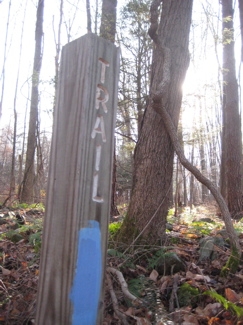
I hiked them in two parts; half in summer and half in late fall. As always, I’ll try to make the most sense out of my adventures, even if I split two trails over the seasons. Further complicating matters is that different sections of the same trails have different names, but we’ll deal with that.
It must be noted though, that the CFPA Walk Book is outdated with regards to the parking areas and the Lakeside Trail, which has been rerouted due to logging and development. So be wary of the parking issue, which certainly appear to be permanent changes. They are, referring to the CFPA map, north to south:
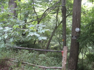
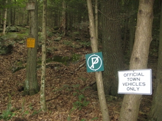
Now that that’s out of the way (I hope I save at least one person the hassles I went through out there), I’ll start with the main (and longest) trail, and then get into the side trails; which are almost all worth hiking as well.
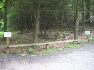
Nice new Parking area towards the end of Hemlock Road
![]()
The Blue Trail, 4.2 miles (one way)
Description is south to north
I parked at the end of Benson Road (as mentioned above) and took the red-blazed Iron Ore Hill Trail down to near the end/beginning of the Blue Trail. While no sane person would be compelled to then do the dogleg down to Iron Ore Hill Road to reach the true beginning of the Blue Trail, I did.
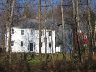
The house across the street from the trail terminus is large and has a distinct architectural flair to it that I’ve found to be pretty common out here in towns like Bridgewater, New Milford, Brookfield and the like. People out here like to give a nod to the agricultural past (and present) by building silos attached to their houses and painting them a different color from the main house. It sounds kind of corny, but somehow it works. Hey, I wouldn’t mind living in a house like that.
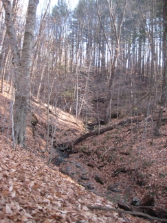
This first section of the Blue Trail is called the Ravine section but to be honest, the ravine here is pretty inconsequential especially when compared to the other interesting stuff along the way. Once the trail turns west and reaches the top of the hill, I began passing some signs. The area to the south of the trail here is the Sunny Valley Preserve Iron Ore Hill Forest Management Area and is one of three host sites in the state where Connecticut Agricultural Experiment Station foresters are investigating forest regeneration after various harvesting methods are implemented.
The study, initiated in 1982, is designed to determine how each method impacts the quality and quantity of oak tree regeneration. I don’t know about you, but I find this stuff pretty interesting. It’s pretty neat to see the effects of the forest management technique right in front of you while hiking.
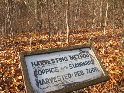
Coppice with standards: A traditional system of woodland management whereby timber trees are grown above a coppiced woodland. It is used in particular as a method of exploiting oakwoods, in which all the trees except a rather open network of tall, well-formed oaks – the standards at about fifty per hectare – are felled, leaving plenty of space for hazels and other underwood to grow and be coppiced at intervals of ten to fifteen years.
The variation of coppicing known as coppice with standards (scattered individual stems allowed to grow on through several coppice cycles) has been commonly used throughout the British Isles as a means of giving greater flexibility in the resulting forest product from any one area. Not only does the woodland provide the small material from the coppice but also a range of larger timber for jobs like house building, bridge repair, cart making and so on.
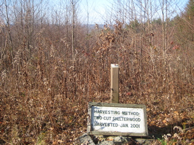
Shelterwood cutting is a silvicultural system in which trees are removed in a series of cuts designed to achieve a new even-aged stand under the shelter of remaining trees.[1] It is similar to selective and seed tree cutting in the way that at no point in time is the ground completely bare, and is thus considered less harmful to the surrounding ecosystem.
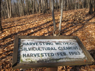
Silvicultural Clearcut: An even-aged regeneration method that can employ either natural or artificial regeneration. Clearcutting can be biologically appropriate with species that typically regenerate from stand replacing fires or other major disturbances, such as lodgepole pine (Pinus contorta). Alternatively, clearcutting can change the dominating species on a stand with the introduction of non-native and invasive species as was shown at the Blodgett Experimental Forest near Georgetown California. Additionally, clearcutting can prolong slash decomposition, expose soil to erosion, impact visual appeal of a landscape and remove essential wildlife habitat.
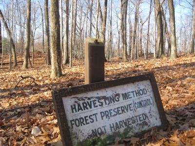
The control. Nothing to see here…

Total clearcut. We know that that is.
The entire time I was checking out the managed areas, I kept hearing what I thought were ATV’s off in the distance. Upon getting closer, I thought they were chainsaws as they stopped and started over and over. However, once I got nearer the first road crossing, I realized the sound was actually that of mooing cows. Man, get these heifers some lozenges already. My word. I don’t know what the reason, but they really sounded like chainsaws across the small valley.
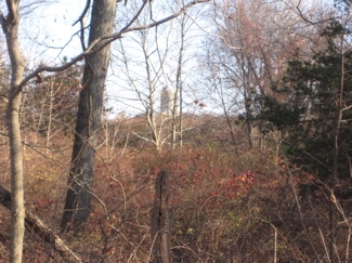
See the silo through the woods? The cows were there.
The next section of the trail past Iron Ore Hill Road is fairly unremarkable, past the Iron Ore Hill Trail intersection, until the crossing of Hitchcock Mill Brook. After the the brook, the trail follows a recent reroute steeply up the side of the hill to Benson Road. The young stretch of trail is pretty funny; once it switchbacks its way up the steep incline, it parallels the road for about 300 yards above the brook below. I guess it’s pretty, but since I’d already done this stretch on my initial hike out to the beginning of the trail, I hopped the guardrail and walked up the road.
There is some private camp or retreat center or something at the end of Benson Road. All I know is that the road is paved very well and the place, right on the Housatonic, looks very nice. I’m not sure if this place is the reason for some of the rerouting, but I wouldn’t doubt it. Anyway, since I had just completed my first loop of the day’s hike, I stopped for a coffee break at my car:
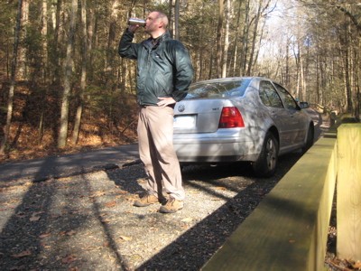
Ahhhh, quite a luxury when hiking, that’s for sure. I also tried eating a stale donut from the day before, but that ended up as squirrel food. After my short respite, I trudged off back into the woods and up a hill – turns out this is the southern saddle of Rocky Hill and was immediately stopped in my tracks after a few minutes by some deer ahead. I saw two large bucks and several does who couldn’t have cared less that I was coming their way. In fact, they snorted at me and essentially told me to bug off.
I can appreciate that from them, but I found this particularly interesting because the week prior and the week hence, deer hunters are allowed in these very woods to cull the herd. So something tells me these deer are most likely dead as I write this.
I made some noise but one doe just stood in the trail staring me down. Are you kidding me?
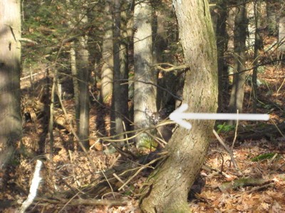
She finally leapt off into the woods and I continued on, around the boulders and small cliffs in the area. I passed the turnoff for the Lakeside Trail and was now on a previously hiked path. This is a nice little section of the trail, even though some of it has been recently logged. A woodland meadow offers a bit of change before the trail sidles up next to some larger cliffs before heading downhill.
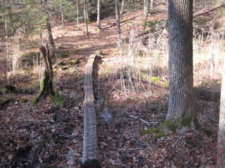
At this point, I’ll switch over to my summer pictures, so don’t be too confused.
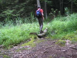
You see how clever I am in seasonal transition?
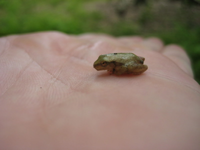
I don’t know how, but while in the meadow in the summer I saw some movement in the tall dewy grass and crouched down to inspect. There, I saw the tiniest little froggy and was able to catch him for his photo op. Man, this little guy was the smallest frog I’ve ever held, that’s for sure. He felt like he could blow away in the wind. It’s also one of the better pictures I’ve ever taken of the thousands for this blog. Kudos to me.
The blue trail sort of picks its way through the craggy area, and even requires the use of hands at one point – although a simple 10 foot reroute would eliminate that need, I still appreciate it. The trail passes the turn-offs for the Lakeside Trail (again) and a white-blazed connector to the Rocky Hill Trail.
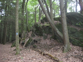
The next bit is a simple downhill grade to Hemlock Road and the new parking area I mentioned above. While some roadwalks are laborious and boring trudges, this one (about a third of a mile) is very nice. The road is very skinny and the stone walls protecting the mansions in the woods pique one’s curiosity as one climbs the paved hill. These houses even have names… Always a sign of wealth – or just pretension. (Mia Farrow lives a few roads north of here.)
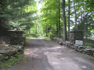
Once to the turnoff back into the woods (the former parking area now plastered with “NO PARKING” signs, the trail gets a bit ugly for a short bit. I guess the landowner wanted to discourage anyone from entering the woods here and jumbled it up a bit. This mess only lasts a short way and before I knew it, I was along the bank of the Housatonic.
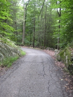
This is a very pleasant and easy hike along the river. I stared out across the expanse to see a few rather nice houses perched above the other (New Milford) side. I had time to dream of such living for the next uneventful mile or so.
This last stretch also gave me time to reflect on the town I was hiking in. Bridgewater… As this is Connecticut’s last official dry town; a town in which you cannot buy alcohol at any store or in any restaurant for whatever antiquated reason. I had come prepared to thumb my nose at the town and its Puritanical silliness. I thought I’d be the lone dissenter in the picture perfect cookie cutter town… But then my Mayberry vision of Bridgewater was shot to pieces:
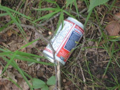
Gasp! A beer can in the woods! Boozers AND litterers! Say it ain’t so Bridgewater! I chalked this distressing turn of events up to an out-of-towner heathen like myself and continued on my way, trying to restore my faith in the town. But then it happened again – this time worse than the last!
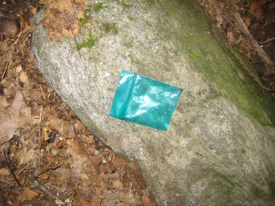
Oh my. I was shaken to my core. (I suppose I should explain to some readers that what you see above is the type of little bag in which marijuana, crack and heroin is typically sold. And yes, I absolutely found this in the middle of the trail here.) Oh my… What will I tell my son? Sigh.
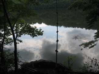
Rope swing the Bridgewater dopers use
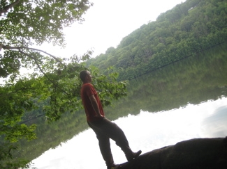
Rethinking everything I know about bucolic Litchfield County towns
Once I reached the end of the trail, which sort of secretly ends at Bridgewater Town Park (I say that because it’s very hard to find the first blaze if you start at the park), I hardly felt like celebrating with my outlaw beer.
But I did – and you can read all about my having a beer in a dry town here.
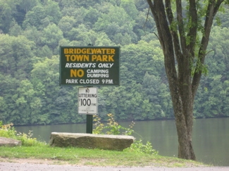
A fitting way to finish the longest trail in Bridgewater if I do say so myself.
(Although at this point I turned around and walked back to Hemlock Road and then up a portion of the Rocky Hill Trail – see below – before reaching my car.)
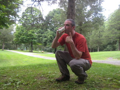
Blue Trail, Done. Ahhhh…
![]()
Lakeside Trail (Red-blazed) 1.4 miles, clockwise
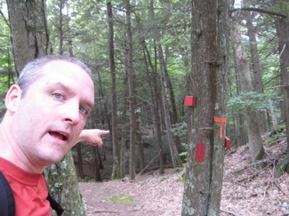
Begin!
The Lakeside Trail is a loop off of the Blue Trail. It has been shortened in recent years by a private owner disallowing the trail on his land. I did this loop in the summer from the little logged meadow area where I found the frog, down to the river (which is called Lake Lillinonah here, which is something strange Connecticut insists on doing in the middle of its rivers), then after a short section along the river, turns tail and goes right back up the hill to rejoin the blue trail further north.
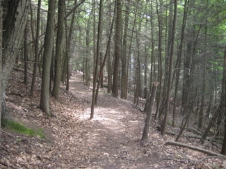
Down the hill…
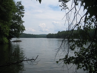
…To the “Lake” (River)
At least the way I chose to do the loop was the easier way, as the northern/western arm of the loop is a more gradual climb that the more direct eastern/southern part. I have nothing further to report about this loop.
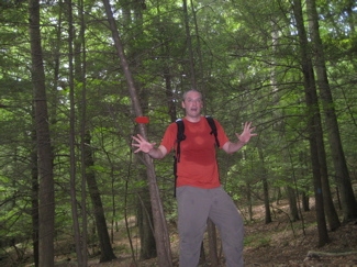
Done! (Hey man, it was a hot and humid July day.)
![]()
Iron Ore Hill Trail, Red-blazed, 1.1 miles
This is the only Bridgewater SVP trail I which I did only in one season: Late autumn.
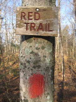
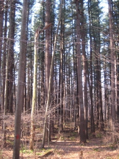
After parking at the end of Benson Road, I walked with a very fit older woman and her energetic dog along the Blue Trail for a short ways and then turned south, off onto the red-blazed Iron Ore Hill Trail. This trail more or less parallels the Blue Trail, just a bit further down the slope towards the Housatonic. It never presents any challenges in the way of ups and downs. There are a few sketchy areas that skirt old stone walls or marshes, but that’s about it.
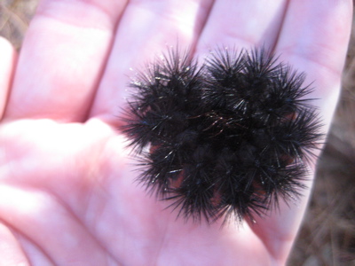
I did cross paths with a fat little woolly bear caterpillar which I noted had a very, very small brown band. I picked him up to inspect him further, but he wasn’t interested and just curled up in a ball in my hand.
Most of us are familiar with the old wive’s tale about Woolly bears being able to predict how cold the winter will be. If this guy was to be trusted, we’re in for a very mild winter… But let’s get some facts.
Do Woolly Bear Caterpillars Forecast Winter Weather?
According to legend, the wider that middle brown section is (i.e., the more brown segments there are), the milder the coming winter will be. Conversely, a narrow brown band is said to predict a harsh winter. But is it true?
Between 1948 and 1956, Dr. Curran’s average brown-segment counts ranged from 5.3 to 5.6 out of the 13-segment total, meaning that the brown band took up more than a third of the woolly bear’s body. As those relatively high numbers suggested, the corresponding winters were milder than average.
But Curran was under no scientific illusion: He knew that his data samples were small. Although the experiments popularized and, to some people, legitimized folklore, they were simply an excuse for having fun. Curran, his wife, and their group of friends escaped the city to see the foliage each fall, calling themselves The Original Society of the Friends of the Woolly Bear.
Thirty years after the last meeting of Curran’s society, the woolly bear brown-segment counts and winter forecasts were resurrected by the nature museum at Bear Mountain State Park. The annual counts have continued, more or less tongue in cheek, since then.
For the past 10 years, Banner Elk, North Carolina, has held an annual “Woolly Worm Festival” each October, highlighted by a caterpillar race. Retired mayor Charles Von Canon inspects the champion woolly bear and announces his winter forecast.
Most scientists discount the folklore of woolly bear predictions as just that, folklore. Says Ferguson from his office in Washington, “I’ve never taken the notion very seriously. You’d have to look at an awful lot of caterpillars in one place over a great many years in order to say there’s something to it.”
Mike Peters, an entomologist at the University of Massachusetts, doesn’t disagree, but he says there could, in fact, be a link between winter severity and the brown band of a woolly bear caterpillar. “There’s evidence,” he says, “that the number of brown hairs has to do with the age of the caterpillar—in other words, how late it got going in the spring. The [band] does say something about a heavy winter or an early spring. The only thing is . . . it’s telling you about the previous year.”
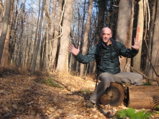
Hm. Interesting. Now that you’ve read that, I’m done with this pleasant little side trail.
Done.
![]()
Rocky Hill Trail, Yellow-blazed, 1.7 Miles
I’ve saved the best – in a way – for last. This trail is the only one in the whole SVP network to have a real hilltop view AND it traverses a very interesting farm/meadow area that took me by surprise. It’s also the only place so far after about 350 miles of CFPA trails where I lost the trail for more than a minute or two. More on that in a minute…
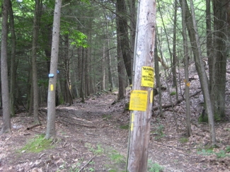
Starting out back at Hemlock Road, right about in the middle of the blue trail roadwalk, in the midst of hidden mansions, a mere mile away from the empty drug baggie, the trail lives up to its name with an immediate fairly rigorous climb up, you guessed it, Rocky Hill. I chose to do this climb as the last thing I did on my summer hike and I can say that it sucked. Granted, it was very hot and humid and I had been doing a lot of running around (and had a beer in my belly, which didn’t help), but I kicked my butt a little bit.
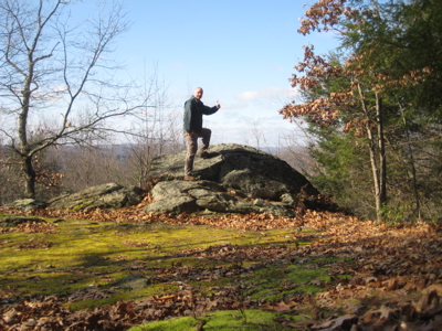
However, once the trail leveled off a bit and the white connector trail joined from the south, I was rewarded with a nice little grassy area and a view across the valley. I took a nice long break here and enjoyed the solitude long enough to almost fall asleep.
I didn’t, and thought about trying to bushwhack down to my car, but that would have been stupid since I had two trail options. Plus, steep ‘whacks through laurel are about as fun as sticking a needle in my eye. So I simply returned to the road via the same trail and went home.
Flash Forward a few months and I found myself at the same overlook after having come in from the south along the Blue Trail and then up the white connector. This time the view was much better, without all the summer haze. What’s striking about this little area is how nice it would be for a picnic. There is a nice patch of grass here and flat rocks on which to enjoy your time here. (Though it must be noted I did smell patchouli in the air during my second visit… so that means the hippies know about it. Ugh.)
On with the Rocky Hill Trail…
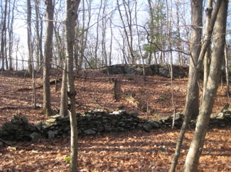
Now, several months later, I left the viewpoint (which oddly isn’t noted on the CFPA map – maps which are infamous for noting viewpoints which view nothing) and continued gradually up Rocky Hill. The trail misses the true 670 foot summit and winds its way through old stone walls and past colonial era roads. The trail joins one of these old roads, descends a bit, crosses a stream and then the surroundings change drastically.
A short, steep climb up through some overgrown shrubs and all sorts of plants with various prickers and those brown things that stick to your pants. This stretch was very slick and annoying, but once on top, I found myself in a reverting meadow. The Walk Book calls this the “Rose Garden” for some reason (perhaps there are roses here in season) and it’s a nice diversion from the New England woods I’d been walking through for a couple hours.
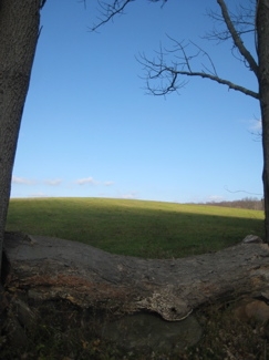
I walked around and took the above picture. Belying the peacefulness of that shot, I realized that the blazes were nowhere to be found. I didn’t bother bringing the trail description (which I know now would have helped) so I found myself taking every mown path, of which there are several, into the woods at various points.
Wrong. Wrong. Wrong.
Sheesh, I’d lost my touch. I noted that a white connector trail led out of the meadow along a stone wall and then down the farmed land out to Christian Street. But I really didn’t want to go that way, as the walk back to my car would have been much longer than I’d wanted to do.
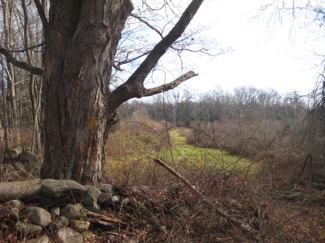
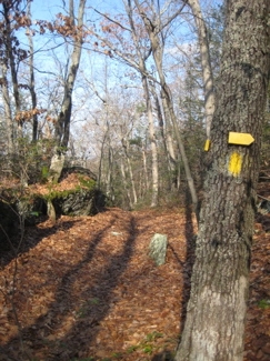
I finally found another stone wall at the back of the field and a faded wooden stake in the ground with what appeared to be an old yellow blaze on it. I kept going in that general direction through some more overgrown meadow and saw another wooden stake in the distance. Aha! I was back on the right trail.
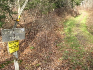
Near the end of the meadow section, which is said to be amazingly rich with birds in season, I lost the trail again before it re-entered the woods alongside a marshy stream which led me out to Benson Road and the short downhill walk to my car.
Despite the nonsense, I loved the meadow area as it made this hike as diverse as one could hope for.
![]() >
>
White Connector Trails
There are four little connector trails here, at strategic places along the trails. I pretty much hiked all four, or at least the vast majority of each one, but if I didn’t mention it in one of the reports above, it’s because it wasn’t worth it to do so. The best/most beneficial one connects the Blue Trail to the Rocky Hill Trail as noted above.

![]()
Sunny Valley Preserve Trails
Nature Conservancy Maps


 Richard Monda says
November 12, 2011 at 8:28 pmBy the way that is my house at the end of the blue trail- don’t be shy and stop by next time
 Karen says
October 14, 2012 at 10:04 amGreat write-up! Thanks. We had a heck of a time finding the parking spot on Hemlock, so now we will pursue it agian for a long anticipated hike. Also, the parking spot on Christian road is great, but when you get into the trail area there are no trail markings although some distinct paths off of a beautiful field. Trouble is that with the warning to stay on marked trails because of bow hunters culling the deer herd, we were a bit hesitant to venture without bright colored clothing! Happy and safe hiking everyone!
 Steve says
October 14, 2012 at 7:34 pmSo when I wrote, “I hope I save at least one person the hassles I went through out there” it may not have been in vain! Huzzah.
 Peter says
January 23, 2014 at 12:30 amI did some hiking here last summer, loved it! If not for this site I would have never known about it!
 tom says
June 23, 2014 at 11:06 amI found a bag in the parking area picked it up like a good Samaritan and saw it in my truck a month later on the floor picked it up and realized it was full of an oregano looking substance.