Everything Ellington
I’ve been exploring and writing about Connecticut since 2006. After a decade, I began compiling CTMQ guides for each town in the state. I plan on “completing” Ellington CTMQ-style… as well as the other 168 towns, cities, and boroughs in Connecticut. That is the ultimate goal of CTMQ.
If I’ve missed anything in town or if anything has closed or changed, please let me know.

![]()
Museums
Hall Memorial Library History Room & Exhibits
Nellie E. McKnight Museum
Hikes
Explore Connecticut’s Ellington Outdoor Guide
Shenipsit State Forest Intro & Trails
CFPA’s Shenipsit Trail – Intro
- Section 4: Walker Reservoir Commuter Lot to Hopkins Road
Section 5: Hopkins Road to Old Country Road
Hockanum River Watershed Association Trails – Intro
Northern Connecticut Land Trust Trails – Intro
- Bellante Preserve
Ernie Boothroyd Nature Preserve
Shenipsit Woods
Sunset Hill
Swann Farm
Wraight Bird Field Conservation Area
Ellington’s Town Trails – Intro
- Batz Property
Kimball Trail
Crystal Ridge Trail
Metcalf Preserve
Food & Drink
CT Beer Trail: Cold Creek Brewery & Tavern (Closed)
CT Mead Trail: Nordic Moon Meadery (Closed)
CT Spirits Trail: Connecticut Valley Distillery (Closed)
Looking for your favorite restaurant? Here is an explanation as to why it’s not here.
Everything Else
US Oldest: Samuel Knight roadside marker
The Ellington Panhandle
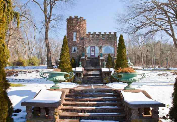
Aborn Castle
The Barn Yard Covered Bridge
Giant Goofy Chair at Kloter Farms
The Scandinavian Gift Shop (Moved)
Ellington: Complete!
I “completed” Ellington in early 2019 but new and/or previously unknown-to-me CTMQ-worthy places and things open all the time, so a town is never really “complete.” I will, of course, continue to visit and write about these new places and things.
Wrap-Up and Completion Celebration Meal at The Chuck Wagon Restaurant

Aborn Castle

 Twelve Mile Circle says
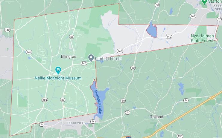
March 25, 2019 at 3:11 pmWhat’s up with that long protrusion to the east?
 Steve says
March 25, 2019 at 6:19 pmI’ve searched for an answer to that question – so far to no avail. My guess is that it was some concession in the water-powered days to allow the town access to the Willimantic River, which is its far eastern border.
 Twelve Mile Circle says
March 25, 2019 at 8:24 pmAh yes, I see that now that I drill down on Google Maps. Oddly, there doesn’t seem to be any evidence of people living along that particular stretch of River Road today… whatever advantage it offered in colonial times seems to no longer exist.