Aw, Cuss.
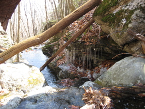
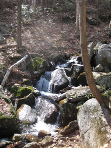
Cusgutter Falls, Bristol
March 2008
For a longer description of the hike on the Cascade and other Tunxis Regional Trails in Southington and Bristol, you can leave and go here.
Aw, cuss… I’m writing up these falls in 2016. I hiked past them nearly eight years ago. If you’ve been following CTMQ for a while, you know that my pictures 8 years ago were in a much smaller format. Same bad quality though. And there’s no way I’m going to go find that old CD with the originals simply to make this page splashier in 2016.

See what I did there? We’re talking about waterfalls and I wrote “splashier?” Click on whatever Google-fed ad is on this page to give me two cents for that bit of deft writing.
Anyway, I remember being sort of amazed when I hiked this area. This is Bristol’s Lake Compounce area. This is that hill behind the park; the very one that the awesome Boulder Dash coaster jolts around every summer. And it offers some fairly challenging climbs and some great views.
Views! In Bristol! I love it.
I also love how “Cusgutter” sounds like some sort of 19th century Carolinian slave slang. “He’s a real cusgutter,” or, “Paw, checking the traps up on the ridge is a real cusgutter.”

The Compounce Cascade trail is wonderful… a real cusgutter. (See, it works either as a positive or a negative.) When one hikes it, one feels as though one is hiking a “real” trail up a New England granite mountain. Perhaps this is simply because the trail doesn’t namby pamby up the hill (the “hill” being the 964 foot Compounce Mountain) but rather just charges right up.
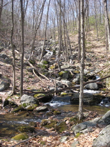
Right up the Cusgutter Brook – so why name it Compounce Cascade for the trail? I have no idea, but it’s a fun, sort of tough (though short) hike. During my hike, at the dawn of spring, the last vestiges of winter clung to the undersides of mossy rocks and in shaded pools. I imagine this trail is nothing short of impossible during spring snow melts. (And, regardless, you’ll want to ascend this trail rather than descend.)
According to the CFPA Walk Book, there are cool names associated with this trail. There’s “The Chute” where the stream drops more than 300 feet in a series of cascades. And a canyon called “Purgatory.” And of course, the “final climb” described in the next paragraph is “Suicide Slope.”
Pure cusgutter, right there.

After crossing the brook a few times and scrambling up, across, and over slickened rocks, the trail evens off a little bit before veering 90 degrees left to cross a couple bridges. It then climbs up again in a final push to the top; here, the vegetation changes drastically to that of laurel and blueberry bushes. Once on top, pitch pine is added to the mix and it’s really quite beautiful.
Also, once on top, it reaches its southern/western end and intersects with the Compounce Ridge Trail again.
(One wonders… if the top of this climb is heavenly, and halfway up is Purgatory… does that make Bristol below, ahem, hell?)
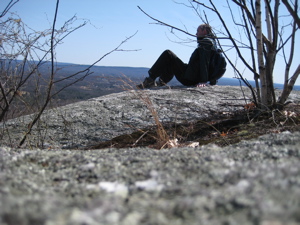
At the top of the Cascade Trail, there is a look-out called Julian’s Rock. It’s rad.

![]()
CTMQ’s Waterfalls & Cascades
CTMQ Tunxis Mainline Trail hikes
CTMQ Tunxis Regional Trail hikes

Leave a Reply