Great Hike? Or Greatest Hike?
McLean Game Refuge (West), Simsbury & Granby
October 2008
Note that this was written in 2008 and you’re only getting tiny picture formats. Also, much has changed at McLean since that time. New Trails, retired trails, new trail blazing, and new attitude towards connecting trails. McLean is a great place to hike, just don’t use this page as any sort of guide please.
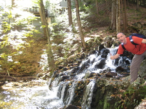
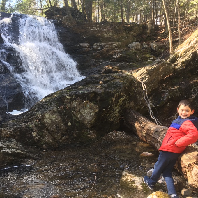
The falls at the beginning of the hikes
Quite a title, huh? Whatever could have driven me to such a superlative? A-ha! You must read onward… The McLean Game Refuge is not too far from home, so I was able to speed up here on another beautiful Fall day to see what the western half of the refuge had to offer. Spoiler: Some cool stuff.
![]()
Westledge Trail
The first thing one notices at McLean is that the blazes on the trees are horizontal for some inexplicable reason. I don’t like it… not one bit. I’ve hiked many miles of many trails in many states (and a few countries) and they are always vertically blazed. Grrr.
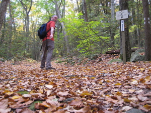
I parked along Firetown Road where the Walk Book told me too. There’s space for three cars there (at the end of the Firetown Trail), but there is parking available closer to the Westledge/Eddy Trailheads, and then again further north along Firetown Road as well. But it hardly matters.
After walking up some wealthy person’s (See comment below) driveway framed in fiery fall foliage for 100 yards, the trail diverges into a yellow wood. Lots and lots of beeches here. Maybe this is where the town’s historical society got their Civil War beech tree. At this point, I was actually hiking the first steps of two trails (the Eddy Loop is the other) and passed a really pretty waterfall almost immediately. There’s also a large stone bench built in honor of Deborah Eddy – but I’ll talk about that later.
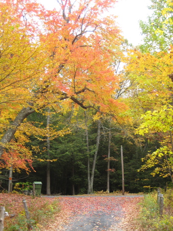
The Westledge Trail is a straight shot, 1.7 miles west then south, entirely in northwestern Simsbury. Actually, who knows how long it is… the Walk Book puts it at 1.7 miles and the official McLean signs say 2.88 miles. Judging by my hike time, I believe both are correct – because you aren’t supposed to park at the western end. That is, it’s an out-and-back hike of about 1.44 miles each way. I’ve found the walk book mileages to be a bit long here and there.
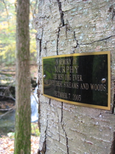
The plaque offers a dedication to a “Murphy, the best dog ever.” I just thought all other dogs should know.
The trail ascends an unnamed 936 foot hill; part of the “West Mountains,” which is fairly high for this part of the state. The land here is diced and sliced in a crazy quilt pattern and the public land is either McLean Refuge land or Simsbury Land Trust land. Unfortunately, the SLT trails don’t officially link to the McLean trails, despite the fact they certainly do. All the “TRAIL CLOSED” and “NOT A TRAIL” signs were my first introduction to McLean’s weird rules about disallowing other entities’ trails to bring hikers onto their land.
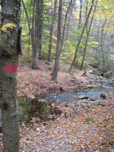
Yes, it’s annoying. Especially when I tell you that McLean’s Westledge Trail has no views whatsoever, but the very, very close West Mountain Trails of Trust land has some beautiful views to the east. I’m going to write a letter to see about this situation.
In fact, I just did. I really did. I’ll keep you updated if I get a response. (I did from Don of the Stewardship Committee –
As you noted, our trails do not connect to anything at McLean Game Refuge. We would be pleased if connections were one day possible, but we understand from the McLean folks that their strategy for the stewardship of their very extensive lands dictates that the portion abutting Simsbury Land Trust be maintained in as close to a natural state as possible, without trails. We have to respect their judgment.
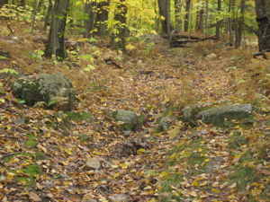
For the record, CTMQ disagrees with the McLean folks and thinks this is a very dumb stance. As you’ll see/read below, the SLT lands that would connect to the Westledge Trail are rugged, extensive, varied, and beautiful.
2018 Update: I was so cute in 2008. Nothing has changed in the 10 years since I wrote the above, and the situation has only become more annoying to me. McLean has a TON of trails with many access points all over Granby. What’s one little connector trail? Google Maps doesn’t care about McLean’s rules:
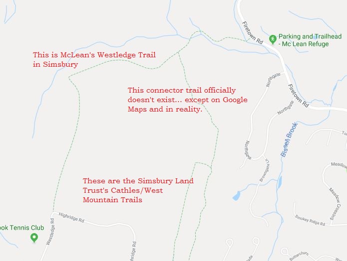
Ha. In the decade since I first hiked this area, I’ve come to realize this situation “officially” exists at other Granby Land Trust properties, the state’s Enders State Forest, and town property like Holcomb Farm. Such beautiful areas, all abutting McLean property… disallowed to connect to it… officially. (In 2023, updated McLean maps showed connection to Holcomb Farm. It’s a start.)
And here’s where it gets really, really annoying to me. The CFPA is currently securing property rights and permissions and blazing an east-west trail from the Metacomet Trail in Bloomfield to the Mohawk Trail in Cornwall – which heads north to the Appalachian Trail. Two National Scenic Trails in Connecticut connected!
Except… the only logical route would come up through Simsbury to McLean and then west to Enders and beyond. Like the CFPA showed in 2005:
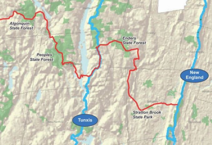
Cool. Westledge Trail, some Eddy Loop, Weed Hill Trail, Pine Cone Trail, and on into Enders. Unfortunately, I sincerely don’t think this will ever happen because of McLean’s dumb rule. I have no idea what the ultimate solution will be, but man… this irks me to no end.
Here’s what McLean’s official 2018 map looks like here, with my additions:
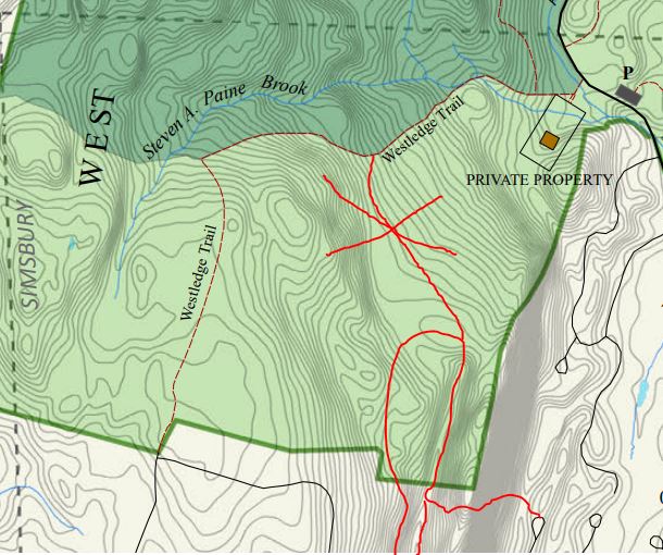
Aggravating. Anyway, back to your 2008 report…
As it is, the Westledge Trail is fairly boring. It does skirt pass by Northgate Falls which are fantastic. After the falls, the trail mosies along an old stagecoach road near a healthy mountain brook. The trail does cross the brook at one point, sans bridge, which I’m sure is rather tricky after rain and probably quite dicey in March and April. At least the trail sign does warn of this issue.
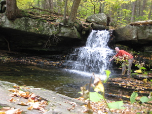
This waterfall is unnamed according to commenters and everywhere else I look.
I also passed some old stone foundations along the way, as this was once a thriving farm community. At one point, the trail climbs steeply up the “Garret Stairs” just before turning sharply south (left). More stone walls and cellar holes pop up along the path – the remains of a 17th Century village called Pilfershire. Gee, did they fail because they were a bunch of thieves I wonder?
Once I attained the plateau, I fast-walked to the end. My fast-walk was made much faster than I’d planned because of the very large, very loud, very aggressive dog who lives at the very large, very expensive house along Highridge Road. I was rather scared, especially since I knew I’d be returning right back past the same dog in about two minutes… what to do, what to do…
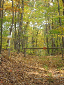
I chickened out. I could see the end of the trail at the road and I could see this dog chomping through my thigh as well. I was confident I could get by him the first time, but the return trip would have been an affront to his primal instincts. But I had a better plan.
I knew I’d be exploring the area in another hour or two, in an effort to get some primo Autumn views from the aforementioned West Mountain Trails of the Simsbury Land Trust. I’d just drive to the trailhead, jump out of my car, take my picture, see if I can get to where I turned tail and call it complete.
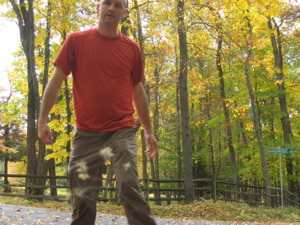
My strangest finishing pose yet (I hit the 2 second timer rather than the ten and didn’t feel like doing it again with that dog coming.)
So that’s exactly what I did – and got some great views on the road too! The dog was still there, still going nuts, but I had some distance and a running car with turbo injection withing 40 feet. Ha.
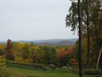
The view northeast at The Knolls and Barndoor Hills over some someone’s private vineyard along Highridge Road, near the end of the Westledge trail
![]()
Eddy Loop Trail
The Eddy Loop shared the path with the Westledge Trail for the first 500 yards or so. After returning back down the hill along the Westledge Trail, I veered north on the Eddy Loop. I wasn’t expecting much from this trail as it merely ascends an 870 foot hill, then descends down to Firetown Road for a 10-15 minute road walk.
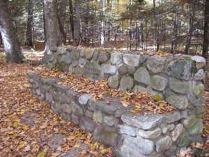
The walk was pleasant enough, if a little featureless. The ascent is gradual and passes by a few interesting rocks I guess. I would probably finish my Eddy Loop report after another bland paragraph, except something amazing happened to me out in those woods on this fateful October day…
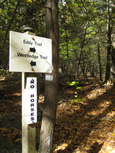
As I crested the unnamed hilltop, I had my camera out to take a picture of it, as I was desperate for pictures of any sort along this trail. I snapped the picture, not even stopping. Just then, I heard the crash of deer running away from me up and to my right.
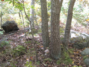
The exciting hilltop
I immediately noticed that these were some clumsy deer, as they seemed a bit slower and crashier than normal. I kept walking towards the sound and looked into the woods after them. Wow, these deer were much blacker, shorter, and furrier than other deer I have seen. And they climb trees too!
Wow! A bear! About 20 feet from me, I watched a cub clumsily climb a tree and stare at me. Since I had my camera out, I took the following terrible picture:

Bear!
I was so excited I can’t even tell you. Finally! My first bear-in-the-woods-in-Connecticut sighting! As I checked to see if my picture was any good, I heard the gruffling and huffling that bears do when they kinda sorta want you to get away. I walked a few more steps and then saw, off to my right and a few feet below her cub, a none-too-happy mama bear staring me down. She wasn’t climbing up any trees or turning tail.
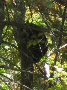
Bear!
Since she was only about 15 feet from me and not backing down, and I was quite alone and a mile from the closest road, I simply slipped my camera in my pocket and kept walking away. Slowly. I’m sure I could have taken what would have been a pretty cool picture, but I have to admit that I was a bit off my game. I wasn’t scared per se, but I wasn’t too comfortable either.
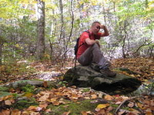
Phew!
As I began descending and the trail curled around back towards the bears, I definitely had some adrenaline aided pep in my step. I crossed a stream, hiked through some stunningly beautiful open woods, hooked up with an old woods road, passed the junction with (and then hiked) the Weed Hill Trail, descended down to Firetown Road, turned right, and made my way down one of the most pleasant road walks I’ve done yet.
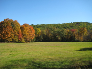
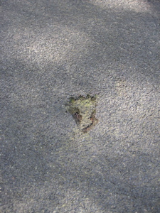
It certainly helps that I walked this during peak foliage time, but I really enjoyed walking down the road for some reason. Maybe because I knew I wouldn’t be eaten by bears. My feelings of ease were tempered a bit after I noticed the bear named Blackfoot wasn’t afraid to venture down to the road:
Almost back to my car, I stepped off the road and onto the short East Loop to complete my day. But first, I must discuss the Weed Hill Trail…
![]()
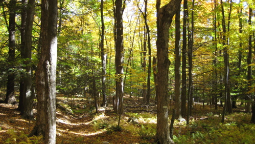
Weed Hill Trail, 1.2 miles (RT), Blue-Blazed
The joke here is obvious – with a name like “Weed Hill.” The funny thing is – this trail is really lame and unimportant and ends at a place where I’m quite positive plenty of teenagers have smoked plenty of weed.
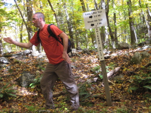
The trail ascends Weed Hill. Annnnnd it parallels a nice old stone wall most of the way. Annnnd the woods are really pretty in October. Annnnd then it just ends.
Actually, it doesn’t “just end.” It ends in someone’s living room. Two couches, a fireplace… nice. An incredibly strange way to end an incredibly silly trail that is denoted in the Walk Book for absolutely no reason. Do not bother with this trail.
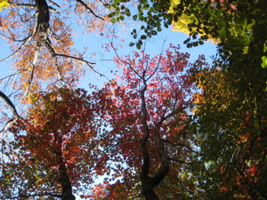
In truth, it is not described in the Walk Book; only drawn on the map. I probably could have skipped it and been officially okay. But then, I wouldn’t have gotten my defining Weed Hill shot:
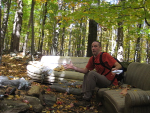
I was actually more afraid of sitting on this and having a family of mice scurrying over me than I was of the bears.
2018 Update: The maps now show the continuation of the woods road trail back down the north side of the hill. This is important for several reasons. One, this would be the CFPA’s East-West trail route if they are ever allowed to do it. Two, it connects to other woods roads that afford the hiker many options.
Like over to the new Pine Cone Trail via Old Beech Road. Like over to Broad Hill Road and some Granby Land Trust trails andGranby’s Holcomb Farm Trails. Also, rumor has it that Old Beech Road continues west into Enders State Forest along the stream with some of the best waterfalls in the state.
AND speaking of waterfalls, at the end of Weed Hill Road (trail) is the beautiful Carpenter’s Falls! Here’s my page on the falls.
McLean is so great for so many reasons – NOW ALLOW CONNECTING-IN TRAILS, DANGIT!
![]()
Pine Cone Trail, 0.7 miles RT
I gave the Pine Cone Trail it’s own page.
![]()
East Loop, 0.7 miles, Blue-Blazed
Another silly blue-blazed trail, this one with a few more blazes than Weed Hill, it at least allows people like me to get in another mile of hiking when our cars are parked at Firetown Road.
Begin!
End!
Other than that, it offers nothing else. But I was still quite happy after a great day out in this part of the state.
![]()
Eastern Region
McLean Game Refuge
McLean Map
CTMQ hikes Simsbury Land Trust’s Trails

 Caroline says
October 22, 2008 at 6:42 amHow is it that you are more afraid of dogs than bears?
 Steve says
October 22, 2008 at 7:39 amY’know, I didn’t even think about that while writing this, but it’s true. The dog was actually twice as far away as the mama bear – and may have even had an electric fence, AND I was very close to a road/houses as compared to the bear encounter.
And yet… yes, I was far more scared of the dog. Of course, dogs can be aggressive and bears are merely defensive, so it really does make sense.
 B-Side says
October 22, 2008 at 10:12 amWhat a lame bear. I bet it totally lost bear street cred for not killing you.
 stew says
June 9, 2009 at 9:32 amlooking for waterfalls to possibly paint in Simsbury at the end of Sept 2009 while I am there for a wedding. Came across your notes & photos of your adventure. Hope to follow your path. If you have any resources or other adventures in this area please forward to my email. Being out of state I find it hard to locate places to go in advance.
 Rob Y says
July 25, 2009 at 12:16 pmHey Steve, the unnamed falls are referred to locally as “Northgate Falls” and yes it’s a great little swimming hole in the summer! I’m impressed you were able to follow that trail up, we used to Mtn bike down it in the early 90’s before they banned bikes.
If you head back to the Simsbury Reservoir Trails in the summer, be aware, urban folklore says there’s a nude beach up there . . .
(One of many dirty little secrets of Simsbury)
 Tim says
August 28, 2009 at 9:35 amHiked the Westledge Trail yesterday, abeautiful late August afternoon with low humidity and a great soft breeze in the woods. Perhaps a boring trail to you, but my wife and I really enjoyed the uphill workout and the walk back in time through the Pilfershire ruins. Agree with you completely about McLean connecting to SLT trails and the excellence of the later.
 Steve says
August 28, 2009 at 11:30 amTim – You’re right, I shouldn’t call it boring. It’s not. Looking at my peak foliage pictures now, in the summer, it looks anything but boring! And yes, anytime our trails take us “into the past” so to speak, it’s definitely cool.
As to the McLean/SLT connector issue, I have been further assured more recently than this article that it just ain’t gonna happen.
McLean wants to keep their trails and their land exactly as they are. Personally, I don’t understand that, but we must respect it.
 Aaron says
January 1, 2010 at 5:43 pmThanks for all the great photos of the trails, the rich persons house at the end of the long driveway where you park “567 Firetown rd” isnt actually rich it was built approxiamately 200 years ago and was the original caretakers house of the mclean game refuge. I had lived there for about 4 years in the early 90s. I never knew what the name of the ruins were pilfershire but ever you ever return and leave the trail to the first large foundation and then turn to the left theres a dark thicket of trees that gave me an eerie feeling and i could never get the courage to look inside. I have since moved away and cannot reach it but look in the thicket, you cant miss it because its a 12 ft high wall of intertwined vines
 Steve says
January 1, 2010 at 6:48 pmThanks Aaron; boy, that house sure is in a beautiful spot.
I do plan on poking around the Simsbury Land Trust Trails in the area in 2010, so perhaps I’ll take you up on that challenge.
And speaking of the SLT and my comments in the original post and here in the comments, I have an update. I’ve recently learned that the McLean Game Refuge is actually a National Natural Landmark (there are 8 in CT in total) and perhaps that is their very valid excuse for the Refuge not wanting to connect to “outside” trail networks.
Note: You didn’t hear it from me, but right near the area Aaron is speaking of, there are a couple trails linking over to the SLT properties. Shhhh.
 Jim Giana says
December 19, 2011 at 9:12 pmI hiked the Eddy Loop, the Weed Trail and the Westledge Trail on December 16, 2011 and found that someone had burned the white couch. I also met 3 bears on the Westledge Trail. The mother bear apparently told one of the cubs to climb a tree, but either he was so inept or scared that he could only get about 3 feet off the ground. The mother gave him this “what a dork” look. Two of the bears were sitting together, at first I thought they were a stump, but stumps don’t usually have snouts or eyes. Fortunately, the bears took off to the right and I took off to the left. I’m almost through with the 400(825) trails, having hiked over 625 miles. I now read your blog before I head out. Keep writing.
I also have a list of about 70 non-CFPA trails in various parts of the state, to do when I’ve completed the 825.
 Aaron Williams says
June 25, 2012 at 10:44 pmBeen awhile since i read your blog, but every time i read it brings me back. A little update. The unnamed falls with the excellent swimming hole are still unnamed. Northgate Falls is further downstream where you appeared in the pic connecting to the northgate housing community. (I think you called them condos.)
Also If you want a good pic of the valley and don’t want to go to talcott. leave the trail and go around the caretakers house and face east. there is remnants of a small garden with a decrepid shed and a stream that connects to the falls further down. If you follow that stream to the east (upstream)and leave it as it starts to bend to the South, you will run into a 2- 300 ft cliff that stands over the northgate community. You will be able to see the entire valley that looks like it should be on a calender.
 Rich says
July 22, 2012 at 5:46 pmThe Weed Hill trail does not actually end in that “Living Room”. If you continue past there it levels out and heads through several preserves. Then starts it’s decent eventually ending at a bridge. There is a short trail at the bridge to “Carpenter Falls” a very pretty waterfall. From the bridge you can get on another woods road to continue your adventure. There are numerous trails off of this woods road including GLT properties Diamond Ledges featuring some awesome cliffs that are popular with repellers. Also another GLT trail leads to the site where an old cabin once stood with a nice viewpoint nearby. You can also access the western Holcomb Farm trails from this woods road. There is another woods road off of here called Old Beech Road which was abandoned many years ago. But this one has not been maintained for a long time and is very overgrown and virtually impassable. But If your up for a challenge I am told this old road leads to Enders Fall. It can also be accessed from enders if you cross to the other side of the brook. So the options here are pretty much never ending.
 Bob Melusky says
December 6, 2021 at 9:25 amCFPA has really dropped the ball in updating their maps here. Now that I am done hiking blue trails east of the river, I figured I would hike these next as they are nearby. The CPFA has four trails, or segments of trails, that have been decommissioned on their online map, plus changes to blaze color on others. I think I have all the changes made in Trailforks, but I have a few snippets to hike yet.
McLean has softened their stance, as there is an actual, sanctioned, sign on the North Trail noting “Trail To Salmon Brook Park”. I have the photo!