Pomp and CTMQstance
Pomperaug Trail, 4.6 miles in Oxford and Southbury
January 14 & September 16, 2012
As I sit to write this I see that I apparently struggled several months ago in figuring out how to present this section of mid-Housatonic River Trails. The CFPA Walk Books call them “Lake Zoar Area Trails,” which is fine, but I felt the need to break them down further in a way that makes sense to me.
There is also scuttlebutt that the fine folks responsible for such things are planning an extension of the Paugussett Trail down nearer the Stevenson Dam on the western side of the Housatonic. [Update: This extension has been completed.] Even today, you can do a fairly short (and pretty, but semi-dangerous) road walk to the dam to continue hiking over to the Paugussett. That would make for a pretty cool day; you could start at the northern end of the Paugussett just before sunrise to see the sun rise up over the hills to the east, take a leisurely hike down to the dam and around and hang out on the eastern overlooks awaiting the sunset. I have the best ideas… That no one will ever do.
For now, let’s just stick to what officially exists – like the Pomperaug Trail. “Pomperaug” was the name of the Pootatuck Native American “Chieftain” from whom much of the land in eastern Fairfield County was purchased by the original European settlers. In fact, Woodbury was once known as Pomperaug. It’s a fairly oft-used word in this part of the state and there’s even a Pomperaug High School. I wonder if they play Pomperaug and Circumstance at graduation every year?
I split my Pomperaug hike into two different hikes: One on the coldest day of 2011-12’s winter and another on a fairly cool late September morning. In January, I also completed a bunch of the side trails in Kettletown State Park (Read about them here). I parked my car in the middle of the Pomperaug at Jackson Cove park, hiked north via the side trails (for the most part), then south back to my car from the Kettletown lot trailhead to my car.
I have no idea how crowded Jackson Cove gets when it’s open, but I imagine it gets pretty crowded. I’m not sure how viable a parking area it is for hikers during open summer hours though, as the Town of Oxford site seems pretty clear about parking fees and residency to use the park. Perhaps there are exceptions made for hikers, but I highly doubt it.
From November to March, the park is closed so it’s no big deal. But I’d be wary during the summer at least, even if you get an early start. And the southernmost parking area for the Pomperaug, at the end of Fiddlehead Lane in Oxford, looks like it’s getting more McMansions soon so that may be a little sketchy in the near future. But maybe not, as there is a space at the trailhead apparently owned by the land trust.
(The Walk Book states “ample parking is available at three convenient points along the trail’s route.” This is true, but with the caveats I’ve written.)

When your sweat’s condensation freezes your zippers, it’s cold.
Eh, just do this hike in winter and you’ll have no such parking/payment issues. I certainly didn’t on that 8 degree windy day in January.
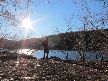
And yes, this is a hike worth doing. Everyone loves hiking along rivers, even if it means countless (small) ups an down the reentrants all the way. It’s pretty and peaceful and the Pomperaug offers many views along the way. I’ve read complaints from other hikers about motorboat noise pollution, but I found no such issues during my crack-of-dawn hikes. (In fact, for the September hike I started in the dark before backtracking after sunrise to take the pictures.)
Geeze, enough boring background stuff and parentheticals. Let’s get to the hike.
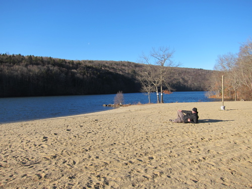
Chillin – literally – at the beach
From the trailhead at Kettletown, near the park entrance, the trail follows a road before heading off into the woods and up a gradual climb. Did I mention that it was freezing cold? It’s funny looking at the pictures here, because it doesn’t even look cold at all. And when is there no snow on the ground in January in Connecticut?
Anyway, this first part of the hike isn’t too exciting, though it was very exciting for me when the sun finally rose up over the ridge to the east. I took a bunch of pictures commemorating this daily event, reveling in my personal excitement, but looking at them now they just look like pictures of trees and rocks.
Then again, all my hiking pictures look like that.
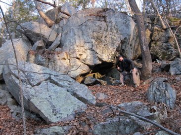
Once up the little hill, the hike is flat and featureless for about a mile, save for one giant glacial erratic alongside the trail. At one point, I had to use nature’s restroom and found it difficult to re-zip my pants.
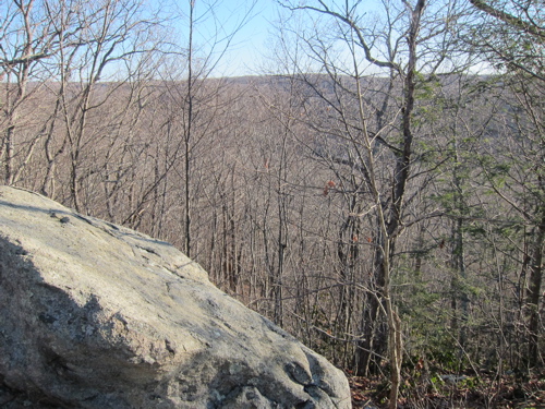
Hulls Hill view
The hill I was up on is called Hulls Hill. There is a view noted on the Walk Book map but, as you can see, it’s not much. Even in the dead of winter with no vegetation to block the view. It was, however, very nice for me at the time because it offered a sunny respite before heading back down into the valley and into the single-digit shadows again.
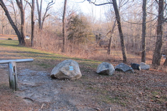
On my way down to the river, I passed what is clearly some of the best/weirdest and most confusing graffiti I’ve ever seen:
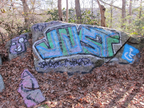
Huh?
Okay, it’s not far from Jackson Cove and roads, so access isn’t the issue. But speaking of “access,” I can’t imagine anyone confined to a wheelchair could get to this rock. The trail up is rocky and even somewhat steep in places, as it rises from the Housatonic. So what’s the story? Is it humor? Or a concerned citizen with a penchant for vandalism?
I really want to know, as let’s be honest, those with a penchant for vandalism are not typically the same people who spend much time thinking about the disabled. Your theories are welcome.
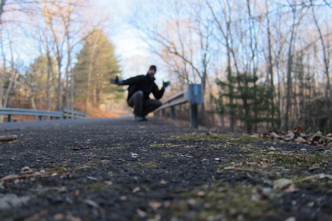
The Pomperaug hikes right at the river’s edge for a little while before reaching Jackson Cove. Once there, I checked out the beach and the playscape. I was, of course, alone on that bitter January day, so I took full advantage and got some early-season sunbathing in before enjoying some sliding action (at bottom).
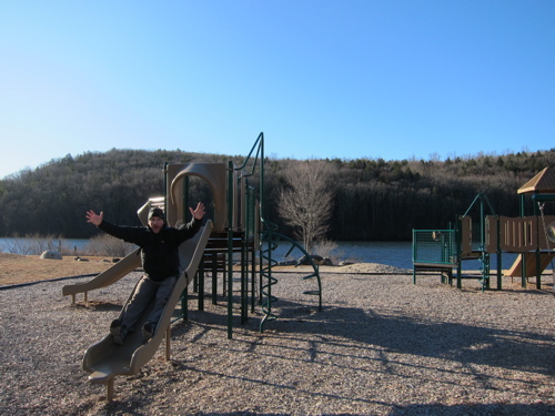
Afterwards, I headed up to the Shepaug Dam for one of their Bald Eagle Open House days. I was not disappointed… Just a bit cold.
![]()
I reached the same beach again in Septemeber via the hike up from the southern parking area. I hiked the very short Oxford Loop on the way up (See Hike 3 here) and found a few more people at Jackson Cove.
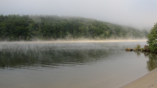
No matter, I walked over to the beach again and snapped a picture of the weirdly hued mist rising from the river. It was definitely yellow. I have no idea why and it wasn’t a trick of the early morning sunlight. It was really a yellow cloud swirling just above the Housatonic’s surface. It sort of bothered me.
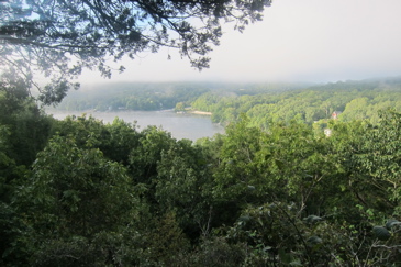
Then I turned to my left to see from whence I just came (and where I was about to head again) an noticed that the hills the trail traverses were pretty much the only place in Connecticut encased by fog at that moment.
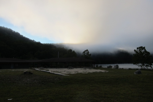
It was a beautiful day. One of the best of the year. And yet, on the Oxford side of the Housatonic River before 8AM, I was firmly encased in a cloud. Oh well… onward – where I would come to learn that the cloud I hiked through wasn’t a rare event at all.
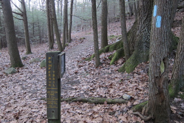
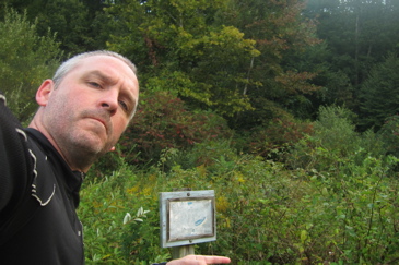
The Pomperaug sort of secretly leaves the Jackson Cove park through the tall grass. For hikers with a map or at least a general knowledge of where the trail goes, it’s not really an issue. But it is kind of odd that there are no visible signs from the parking lot or lawn near the pavilion. Eh, I think I kind of like it that way.
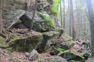
The trail climbs in earnest for a few minutes, as if to purposely get away from the summer crowds and up to a spot that only people who WANT to hike the trail will hike up to. The Pomperaug crosses a bunch of brooks and creeks and rivulets. This southern section of the trail would not be fun after or during a heavy rain. There are no bridges and some of the brooks I crossed looked like they have the potential to be fairly serious when they wanted to be.
These 2.3 miles are also somewhat rugged as well. That is, way more rugged than you’d think a river walk in Oxford, Connecticut would be. No, it’s not New Hampshire – or even western Connecticut for that matter, but I’m telling you, if it’s wet, you’re going to fall.
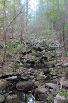
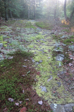
That’s because there are several areas, high up on the hills, covered in various mosses. Some of the greenest and most lush moss beds as I’ve ever seen around here. Mosses living in concert with other mosses and lichens and fungi. I find these areas beautiful and fun to hike through; if only because they are somewhat rare in Connecticut. Especially in September after a dryish summer.
And that’s why I think that cloud that I hiked through here is a near-daily occurrence. Just my dopey hypothesis.
Despite hiking along and above the Housatonic, there really aren’t any good views of it until very near the southern terminus. There were a couple “winter views” that were blocked with the foliage, but I’m not even sure they are all that great. Instead, I focused on the topography and geology of the area. These hills are much steeper and deeper than most people realize, especially when considering the long and steep drive down to Jackson Cove or to the Fiddlehead Road parking areas.
I passed under and around a huge stone cliff and up and down several rocky precipices along the way. That’s not to say the area is inaccessible – it’s not, as I came across another abandoned car. It has been a while since I’ve seen one. (I was mildly annoyed that in the pre-dawn fog of my outbound hike earlier, I had completely missed this thing.)
I passed a couple guys hiking near the end of my day and we exchanged wary glances. Sort of, “Really? Someone else is hiking the Pomperaug through the only cloud in New England right now?” and continued on to my car.
I suppose I should have been a little more celebratory, as not only had I finished the Pomperaug, but I’d finished the “Kettletown State Park trails” AND the CFPA designated “Lake Zoar Area Trails.” That’s like a whole section on CTMQ which I can now put a completed check next to.
And I love that.
If you’re wondering, yes, I did smudge my camera lens early in the September hike. So in the upper corners there’s that weird bright/smeary thing going on. Oh well.
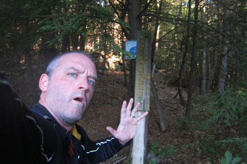
Pomperaug, Kettletown and Lake Zoar Area trails… Done!
CTMQ’s CFPA Blue Trail Challenge
CFPA Trails Map
DEEP’s Kettletown State Park Page
CTMQ’s Kettletown State Park Page

 Geoff says
November 24, 2012 at 10:27 pmThis trail years ago was alot longer and started in Trumbull at Beach Park. As new home construction increased the trail began to disappear. Well i met a really nice lady in 1973 on this trail and we dated for 9 days until I was dumped for a thru hiker from North Carolina who was on his way to Maine. Oh well the trail was great.
 Southbury Tim says
July 28, 2017 at 10:01 pmAny mountain biking allowed on this trail?