Section 4: How’s it Hanging, Hills?
Chamberlain Highway (Route 71) to Edgewood Road, 6.5 miles
May 28, 2007
Note: This page was written in 2007, so please forgive me. If you want to start at the beginning of the trail, go the Metacomet Intro here.
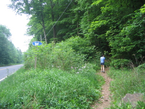
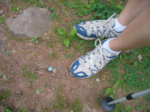
Ah Memorial Day; hot dogs and barbeque, corn on the cob and the Indy 500, puppy dogs and parades, potato salad and political posturing, flag waving and hiking. That’s right, hiking. Over six miles of it to be precise – smack dab in the middle of Connecticut on a slightly hazy but still very nice day. What better way to celebrate our country than to enjoy its great outdoors? I know I can’t think of any better way, so off we drove to Berlin, CT and the spot where we last left off the Metacomet Trail – as seen in the picture here.
We dropped Damian off at Hoang’s parents believing this stretch to be far too long and slightly too dangerous to have him on my back the whole time. And thank goodness, because it was both. Once parked, I pulled out Hoang’s trusty old hiking poles and handed them to her. This caused her to exclaim, “You brought my poles? I don’t need those things!” Mmm-hm. We’ll see.
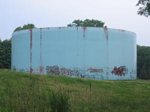
From Route 71 the trail climbed fairly steadily but not steeply at all. There was some humidity in the air, but nothing to worry about. Before too long, after seeing a few houses through the thick woods, we came upon an ugly water tank covered in graffiti. These are the unique sites you can expect to see when hiking a trail right up through the gut of Connecticut. Just beyond the blight is the Elmere Reservoir – a quite small little thing without much unforested bank to speak of. We crossed a dam in the middle of which was a guardhouse of some sort ensconced in razor wire. What the heck was inside that tiny little building? Nuclear secrets?
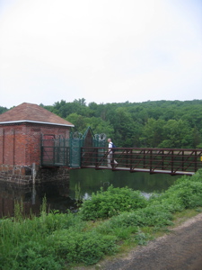
I felt like a guard would spotlight and shoot me at any moment.
After the tiny reservoir, we hiked through some fairly dense spruce forest and popped out onto a park road. Just beforehand, though, Hoang noticed a robin’s egg in the middle of the trail. We moved it aside (as if it’ll hatch) and navigated the somewhat confusing short section across a dam at the end of the Merimere Reservoir. Here, we came upon a few other folks out enjoying the nice day. There were two birdwatchers who seemed to be very annoyed at our approach. We were quiet and just as curious about the bird they were peering at as they were! I hope you get your eyes pecked out.
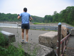
Dam!
Damn!
Although I shouldn’t be so angry – for it was right there, spray painted in the middle of the road, that we saw some kindly good-natured graffiti! Quite a rarity indeed; certainly rarer that whatever bird those nerds were looking at. Oh, wait.. “be good to each other…” I mean, certainly rarer than whatever bird those fine young birders were seeking.

I gave Hoang a hug at this spot.
With a few confused onlookers, Hoang and I followed the blue blazes diligently off the (closed) road and down into the woods. Did I write “down?” Because “up” was the only item on the menu for the next mile or so. The trail heads due south at this point, climbing up the basalt cliffs bordering the Merimere Reservoir. There were a few creeks to cross – and the only way to do that was to head straight down and then straight back up. I was surprised at the intensity of the trail here and relished the first “true” hiking experience on the Metacomet heading north.
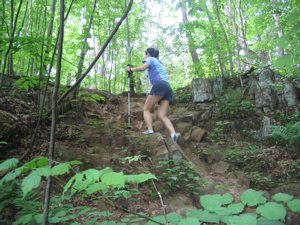
Up…
There was no need to use our hands, but just a few more degrees of steepness would have warranted that. It was at this point when Hoang realized she was thankful for her hiking poles – and even had the kindness to tell me. We did pass a few hikers coming the other way, which was certainly nice to see.
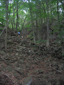
…And up some more
After several very steep ups (and maybe one down), we reached a plateau of sorts. A very light drizzle began falling (almost imperceptible) which was actually quite welcome after working up a sweat. It stopped as we reached the first part of our whole Metacomet hike where Hoang and I sort of stopped to say to each other, “Ah, yes, this is why we’re doing this.”
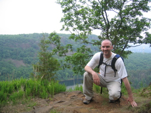
It was beautiful – and unexpected. I’d seen these hills for years while driving on 691 and 84 for years; towering dark brown cliffs shadowing the town of Meriden below. Now here we were, up on top of those 600 foot cliffs, and it was really, really nice. I’m serious! In central Connecticut. The pictures here are sort of hazier than the reality.
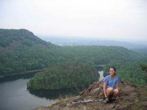
Hoang is much closer to the sheer edge here than you’d think
That’s Mine Island down below there in Merimere Reservoir and that’s Meriden in the background behind Hoang. We took a short break to rest and enjoy the view and then continued onward along the top of the cliffs, passing a lot of really cool basalt formations. We also passed some random guy up there who was alone and praising Jesus for the beauty of the spot. He seemed a little “off” to us, but we were polite and continued towards the next major trail hotspot…
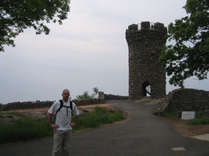
Castle Craig. Wow! A castle on the Metacomet Trail?! Well, not really. It’s just a 32 foot high turret with steps up to the top to take in the scene. But why? No one really knows, but Walter Hubbard built it and dedicated in 1900. Some say it’s a mock-up of some castle in Scotland, some say it’s inspired by a 12th century Turkish castle on the Danube. Whichever, it’s kind of neat and totally random.
[For more on Castle Craig, CTMQ has a dedicated page.]
On clearer days, one can see Long Island Sound and the Berkshires in Southern Massachusetts. Since we had some mugginess, I’ll settle for telling you that we were in Hubbard Park which was built by the Walter Hubbard I mentioned above; but helped along by none other than Frederick Law Olmsted.
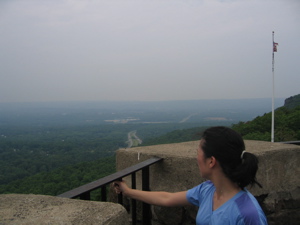
Frederick Law Olmsted was an incredibly prolific, incredibly skilled landscape architect. The little thing called Central Park? His design. Mont Royal Park in Montreal where I happened to propose to Hoang? His. The grounds of Yale, Vassar, Bryn Mawr, Haverford, American, Berkeley, etc, etc, etc? His. You almost can’t believe what Olmsted designed. And it’s cool that he was born in Hartford, CT.
Immediately after Castle Craig, we searched for the blue blazes, found them, and then we plunged a little further south to the true summit of East Peak. Interestingly, to me, just past this spot is the geographic southermost point on the Metacomet Trail. From that point forward, it goes pretty much due north from here on out. Though not as much as it should.
You see, after leaving the parking lot area, we hiked along a park road and then were confronted with a decision. I noted on the map that the trail went due south, then a jog west, then due north – rejoining the road we were standing alongside a little ways up the next mountain.
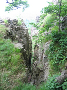
The problem was, we were staring straight down a ravine and judging by the map, all we were going to do was turn around and climb straight back up another ravine on the other side of the hill. And that seemed stupid to me, especially considering we could walk right up the road to rejoin the trail. I mentioned this to Hoang who made me feel like a chump for even suggesting we “cheat” and we began ambling down the rock-filled wide ravine.
It was not enjoyable in the least. we stumbled along, reached the bottom, intersected a wide trail, turned right, wondered why the heck we just went straight down for 1/3 of a mile, then turned right again – and faced the same rocky wall we just came down. Argh.
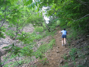
This fun little diversion added nothing to the trail or to the experience. It only served to make me angry. I know trail designers like to keep hikers off of roads, and I get that. The AT is infamous for its “PUDS” (Pointless Ups and Downs). Hoang was mad, I was angry, but the haze was lifting and I had a good feeling. Once we reached the top of the climb, though only halfway through our hike, the rest would be either flat or downhill.
We plodded on, reached a road near the top and took a moment to rest. Ahhhh… trails in Connecticut weren’t supposed to be strenuous like this. But were supposed to be scary?
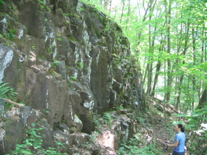
Ah, yes, the ol’ Black Dog of West Peak. The Hanging Hills consist of the already conquered East Peak, the yet to be conquered Lamentation Mountain across the Berlin Turnpike on the Mattabasett Trail, and the peak we were nearly on top of – West Peak. And if West Peak is famous for anything, it’s the legend of the black dog.
LONG story short, there’s an old legend about a scruffy little black dog who curses you with bad luck or death upon seeing him. With that in mind, Hoang and I were initially a little freaked out to happen upon… this!
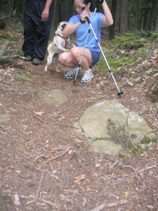
Okay, so he wasn’t black and he was with his owner and we didn’t die, but darnit if it wasn’t a little dog on West Peak! Awwww. And After passing some TV towers and picking our way past the fences and roads, we reached the summit of West Peak and got some great views.
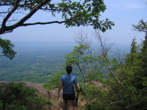
It reminded me of Talcott Mountain near my house, except with a nice lawn. Clear sky, coolng breeze, easy walk… Hiking right along the ridges of West Peak through a grassy and level trail was transcendent.
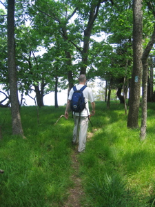
This happy-go-lucky hiking continued all the way gradually down from Meriden, into Southington, and back to Berlin – the town where we started. We passed a couple cool basalt formations and crossed a couple trails, but the final miles were pretty uneventful… except for this pile of leaves:
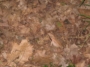
Say what? Can you spot why this pile of leaves is cool? Answer here.
Before we popped out onto Edgewood Road and our car, we reflected upon the 6+ miles we just hiked. For we just climbed to the highest point south of Cadillac Mountain Maine within 25 miles of the Atlantic Ocean – all the way to Key West.
Wow, that’s pretty cool.
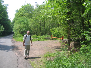
Official stop point of Section 4: Edgewood Road in Berlin
Continue on to Section 5: This Hike Was All Business
CFPA Trails Map
CTMQ’s Metacomet Trail Intro

 Jeff says
June 11, 2008 at 8:06 amGreetings form Florida:
I read your journey, interesting! As a child in the 70’s I remember my dad taking me hiking on the Blue Trail and Elmere Reservoir in Meriden. In fact during the 1940’s my dad and his two best friends discovered a natual rock formation in the shape of a French Poodle dog overlooking the Elmere Reservoir. My dad sent a photo and story into “Ribley’s Believe It or Not”. The picture you took of the water tank, I remember passing it on the way to the “French Poodle Rock”. If you go back look for the “French Poodle Rock. Though, it’s hard to find. You have to know what to look for.
 Jeff says
June 11, 2008 at 8:08 amOh yeah, I also have fond memories of Castle Craig. I sure do miss Connecticut.
 Larry Cebula says
July 14, 2008 at 4:23 pmI did this section in February–I faintly recall finding a west facing ledge to cower under near the castle to enjoy the concentrated late afternoon rays. Looks nicer in the summer.
 Tim says
June 8, 2009 at 11:52 amI love this website and have learned a lot from it. I’m curious as to if anyone has ever been on mine island? When I drove past it, it looked mysterious and desolate. If I wasn’t in florida I would swim there myself, but it looks like only the hardcore would go there
 Mike H. says
November 5, 2012 at 12:18 amI have to tell you how thrilled I am to find this site! I just got back into day hiking, & I’ve been living on here to see where I should go next!
I actually started at the northern segment of the Shenipsit Trail, but this past weekend decided to try Castle Craig after reading your reviews. We didn’t do the whole leg just from 71 to the Castle & back…. Amazing time with amazing views! I know it’s been a few years since you wrote this, but great work!