Terry’s Pain in the Butt Area
Simsbury Land Trust’s Case, formerly Terry’s Plain Area, Simsbury
October 2013
Because I care about you, dear reader (and the singular is probably apt here), I have thought long and hard about how to best present the trails and historical sites in this unique little part of Simsbury. What’s more, with the Simsbury Land Trust’s 2016 (and beyond) Walk Book, they’ve done away with any of the explanations of the places beyond their Case property. But I’m going to keep everything I’ve written here (based on the 2012 or so Walk Book) because I like it.
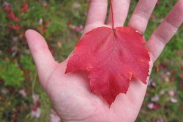
My title to this page is purely in reference to my trying to marry up information about all the stuff here from a wide variety of sources – online and in print. Exploring all these areas can be done in 45 minutes at a leisurely pace; assuredly not a pain in the butt. By the way, this is a red maple leaf. Three points, R-E-D.
There are trails, sure, but they are pretty lame. More importantly, there are several historic sites within the Terry’s Plain area. Heck, there’s even a some state WMA near the Farmington River as well.
So here’s what I’ll do. I’m going to put everything on this one giant page, but I’ll be nice and plop in a table of contents so you can either read/skim it straight through or just check out what interests you. Thank me later.
Terry’s Plain Introduction
Simsbury Wildlife Management Area
Site of the First House in Simsbury
Site of the First Ferry in Simsbury
Site of the First School in Simsbury
Colonial Traineband Field – Wegner Property
Case Property/Wet Meadow
Ketchin Quarry (separate page, but still part of the area)
Terry’s Plain
The following is directly from the fine folks at the Simsbury Land Trust. I have nothing to add, so I won’t add anything:
The northeast quadrant of town, east of the river, consists of varied terrain and a pattern of narrow, winding roads, historic buildings, and agricultural uses that create a pleasing texture of scenic vistas. Resting on an ancient and fertile glacial terrace, Terry’s Plain is tucked between the basaltic ridge that forms the town’s eastern boundary and the Farmington River, the latter having spent the past 10,000 years cutting the present-day floodplain out of the terrace.
For most of this period, Native Americans lived in permanent villages along the river and created agricultural fields. From his nearby flower farm, the late Leslie Dewey assembled an extensive collection of pre-Columbian artifacts, some of which are on permanent display at the Simsbury Public Library.
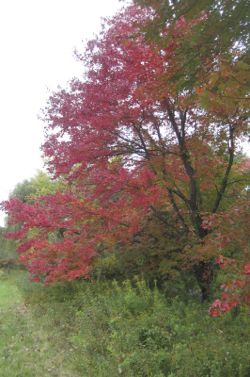
Named after one of the town’s early farmers, John Terry,Terry’s Plain was the early gateway to Simsbury. In 1648 the first colonials, John Griffen and Michael Humphry, followed pine trees for their tar and pitch business up the river from Bloomfield. From then until well into the 20th century, Terry’s Plain remained farmland, producing food crops and tobacco. As with many early communities, residents built their farm buildings on the terrace, grew crops there and along the floodplain, and gathered wood and pastured livestock on the hillsides. At the base of the hill, one farm also quarried stone on its land.
As with most areas in town, Terry’s Plain has changed in recent years. Residential development and new roads have nearly tripled the population over the past three decades. Virtually all of the hillside and portions of the terrace and floodplain have been allowed to grow back into brush and woods. Nonetheless, several sizable parcels remain as open fields, invaluable as rich farmland and providing, along with the woods and wetlands, delightfully diverse wildlife habitats.
Simsbury WMA
If you spend the time in this historically rich area, you’ll also spend some time in the state’s Wildlife Management Area. Please don’t do this during pheasant hunting season though.
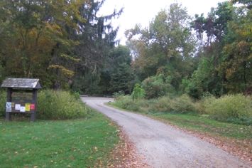
As with many WMA’s, there are some access roads, some overgrown trails, lots of ticks and scrubby grasses and brush. Perfect for pheasant stocking and killing I guess.
Site of the First House in Simsbury
Every town in Connecticut has a “first house.” Or, more accurately, “First white guy house.” Not too many mark the spot with a handsome monument though. For some reason Simsbury does and since I happened to be at the very spot, I took a picture and will now tell the story.
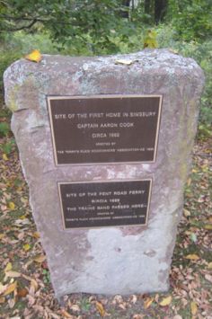
At the end of Ferry Lane there is a state wildlife area. Feel free to check that out on your own time. There is also the aforementioned stone marker and a rather lengthy description of the first house, courtesy of the Terry’s Plain Homeowner’s Association.
I’m not about to transcribe the whole sign here, so here are the highlights, such as they are.
The land where the house would be built was granted in 1653 to Thomas Ford, although a house would not be built until approximately 1660, when Captain Aaron Cook, the son-in-law of Thomas Ford, built the first home in Simsbury. The land was subsequently deeded to John Terry in 1677.
The sign at the site goes off on some random tangent about how a few guys gathered at this first home to decide upon where to build the first meetinghouse in town. It even describes the labor costs and materials used for said meetinghouse. You don’t care about that. No one cares about that (Except for when you and I visit the Simsbury Historical Society museums and check out their replica of this first meetinghouse, of course.)
The piece of brownstone used here was repurposed from some old bridge that used to span the river. And where did the stone for the bridge-now-monument come from? From the Ketchin Quarry a short ways away, of course.
Site of the First Ferry in Simsbury
Conveniently, this site happens to be at the same site as the first home. Well, at least the sign is in the same place. Again, there is a long explanatory sign here that I’m not going to copy for you.
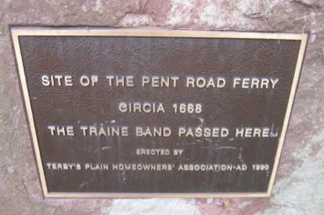
No one knows exactly when the ferry got up and running but we do know it was called the Pent Road Ferry and crossed from this corner of Ferry and Goodrich Streets over to the area of Simsbury where the town offices now stand. This got the Traine Band boys over to their training grounds a quarter mile away (more on them in a minute) and helped farmers get to where they needed to go.
Blah, blah, blah a bridge was built here in 1750 but then the ferry was recommissioned six years later. So that bridge was a piece of junk, obviously.
Today, there is no bridge and no ferry. Just a sign and a “lost owl” sign that has been hanging here for at least a year (2012-2013).
Site of the First School in Simsbury
The first school in Simsbury was located in Terry’s Plain, yes, but up off of Quarry Road. The town agreed, at a town meeting on December 17, 1701, to “agree with and appoint a school master”. The first day of school commenced on the first day of January 1702. The town discussed whether the school should be located on the east or west side of the river, and chose both, with the first three months to be held at a location in Terry’s Plain, and then at a location in “Weatoug” on the west side.
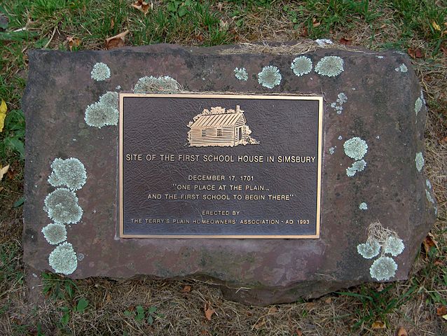
I’m lichen this plaque.
But I guess the eastern school was built first? Or are these Terry’s Plain Neighborhood folks just a bit eager with their signage? Who knows.
Colonial Traineband Field/Wegner Property
Alright, you’ve been very patient. Who was this Traineband militia and why do we care? Go on up Goodrich Road from its intersection with Ferry Road to check out another handsome monument:
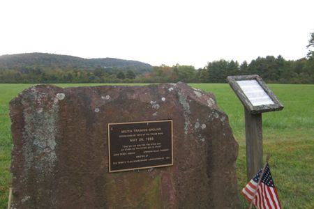
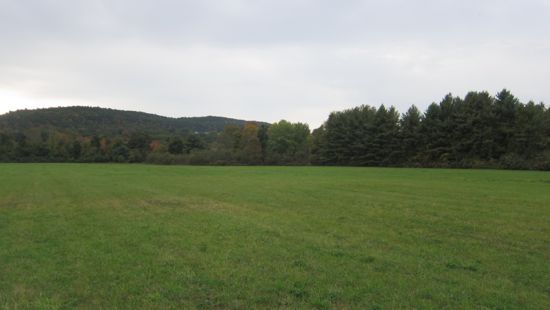
I enjoy the starkness of this area. I’ll dispense with the “hike” portion of the property, because all you do is walk across a field and back. This isn’t a Trust property – though the view of the Talcott Ridge is quite pretty. No, this is a historically important chunk of flat land, and building ugly floodplain McMansions on it would just be awful. There’s a lone tree here, planted to honor an early champion of the Simsbury Land Trust. A fitting memorial, that’s for sure. Anyway, here’s a bit from Wikipedia:
Simsbury was founded as a town in 1670. Not long thereafter, the town established a militia, then known as a “traine band”. The date of establishment of the militia is not known, but records of assemblies date to 1673. The Grand Committee of the Militia met in Hartford on August 11, 1673 to organize militia against a potential attack by the enemy. The Committee ordered the raising of 500 “dragoones” from the state, of which 160 were to come from Hartford County. At that meeting, Simon Wolcott and John Griffin of Simsbury were appointed to command the Simsbury Traine Band, which at that time numbered seven “dragoones”.

The “enemy” at that time, believe it or not, were those dang Dutch. And of course the Wampanoag.
Originally, the Wegner parcel was part of a 50 acre land grant from the General Court of Hartford in 1653 to Thomas Ford of Symondsbury, Dorset, England. Six years after Simsbury’s establishment, the town was attacked by the Wampanoag Indians led by Metacom, the fabled King Philip. Forty homes, some barns and other buildings were burned. Whether King Phillip watched the conflagration from a cave up on Talcott Mountain or not, this legend of “firetown” still excites those who hike or gaze up at the basalt ridge framing the east side of the Farmington Valley.
CTMQ notes – over on an old page about my hikes through McLean Game Refuge up at the Simbsury/Granby line, I wrote, “I was in the area of Simsbury north of the place historically called Firetown. Firetown was a small settlement located about 2 miles northwest of Simsbury center. It extended west to Old Farms Road. Various stories suggest its origins may have been based upon furnaces or forges in the area.” History can be hard and never trust Wikipedia implicitly.
The next bit is from the Trust and the Simsbury Historical Society:
A militia did exist at that time and was instrumental in evacuating the inhabitants of Simsbury to safety in nearby Windsor. However, the original Simsbury militia training ground was on the west side of the Farmington River at the site of the current Town Hall. No bridges spanned the river and unreliable ferry service made assembly by members who lived on the river’s east side difficult. It was decided in 1685 that the original land grant, which was then owned by Ensign John Terry, should also serve as a militia training ground for the citizen members of the “traineband” who lived on the east side of the river. A large sandstone boulder from the Ketchin quarry was erected by the Terry’s Plain Homeowners Association in 1993 to commemorate the east bank training site of the Simsbury militia.
In 1993, the then owners of the land who were charter members of the SLT, Patricia Wegner and her husband Arthur, donated the 15 acre parcel to SLT. The land had been cut for hay and today is still a hay field. A red oak tree was planted in 1997 to commemorate Martha Austin’s long service to the land trust. The Wegner’s generous gift to SLT will enable the lovely, flat, meadow edged with bluebird houses that lies between the Metacomet ridge and the tree-lined Farmington River, to remain much as it was over 350 years ago.
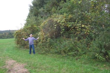
And now we know. And what the heck, since I didn’t bother with a hike description and I’ve pretty much ignored the state property that abuts the river, I’ll give the SLT the floor once more:
Although walking in the field during the summer growing season is discouraged, a dead-end path runs from Goodrich along the tree line on the southern edge of the field. Along this path the field borders a row of pine trees and an alder swamp, an ideal place to watch birds and small mammals. To see the steep drop to the floodplain up close, cross Goodrich Road and the long, narrow hayfield to the west. From this vantage point you will see a brush swamp that leads directly to the river. This land is a state wildlife management area and is stocked with pheasants for hunting from October to mid-winter. We do not advise people to walk in this area during those months.
The Wegner property is pretty much ignored in the 2016 Walk Book. It’s now all about the Case.
Case Property/Wet Meadow
Accessing this property is easy enough, just around the 90-degree curve from the last. You’ll see the trail head. Trust me.
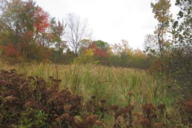
I parked and hiked in quickly through a partially cleared field. There is actually a grid system of trails here, but nothing too exciting – unless you’re a birdwatcher. I’d bet this is a great place to see birds.
Although you can see all the trails at once (this is a small property), some boy scouts seem to have named each trail and have taken great pains to do so. This is absurd to this 40-year old, but when I was a scout, I would have totally done this as well.
Let’s wrap up our learning today with a bit more from the SLT:
In the 1600’s Ferry Road continued to the center of town and connected the town’s two militia fields. There was no bridge at the time; people crossed the river by ferry. Also state wildlife land, this is a great place to observe hawks and a myriad of other wildlife.
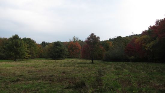
Further down Ferry Lane toward Terry’s Plain Road lies the Land Trust’s 11-acre Case Property. Part of the Simsbury Land Trust’s management plan for this property was restoring approximately six acres at the center of the site to a natural wet meadow habitat. There is a network of walking paths throughout the site, and these provide great views of the meadow and the tremendous variety of plant life, insects, birds, and small mammals that abound there. Hikers will pass through a section with a cattail swamp, alder thickets, and saplings of evergreen and hardwood, a sharp contrast to the more open stretches.
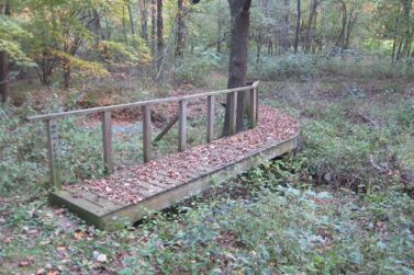
Penwood Brook, which runs through the property along the north boundary on its way to the river, adds another wildlife corridor to the site. The “duck pond” at the northeast corner is actually a manmade fire pond leased and maintained by the volunteer fire department. As with the Wegner property, we ask that hikers respect the signs that indicate points where the paths enter neighboring private property.
I’d interject to request you respect private property signs wherever you may be hiking.
I walked around the property on a lovely fall day and didn’t see much. I was thoroughly impressed with the well-made bridge over Penwood Brook, however. I can’t imagine too many people every use this thing, as it’s on a dead end spur out to that duck pond water hole that is actually next to Terry’s Plain Road (it’s not that nice).
But what the heck, ticks aside, this is yet another cool little spot to perhaps take the little ones on a little hike.
Conclusion
Here’s the deal here: None of these trails are worth hiking on their own. But put together, as the SLT and I have done for you, and combined with the rich and fairly important history of the area, I hereby declare it totally worth it.
One last note: This stuff is all along Ferry Lane and Terry’s Plain Road, not to be confused with Bloomfield’s nearby Terry Plains Road. Simsbury wins this Battle of Lexicon.
![]()
Simsbury Land Trust
CTMQ Hikes Simsbury Land Trust’s Trails
CTMQ’s State Wildlife Management & Field Trial Areas
CTMQ’s Houses, Ruins, Communities & Urban Legends

Leave a Reply